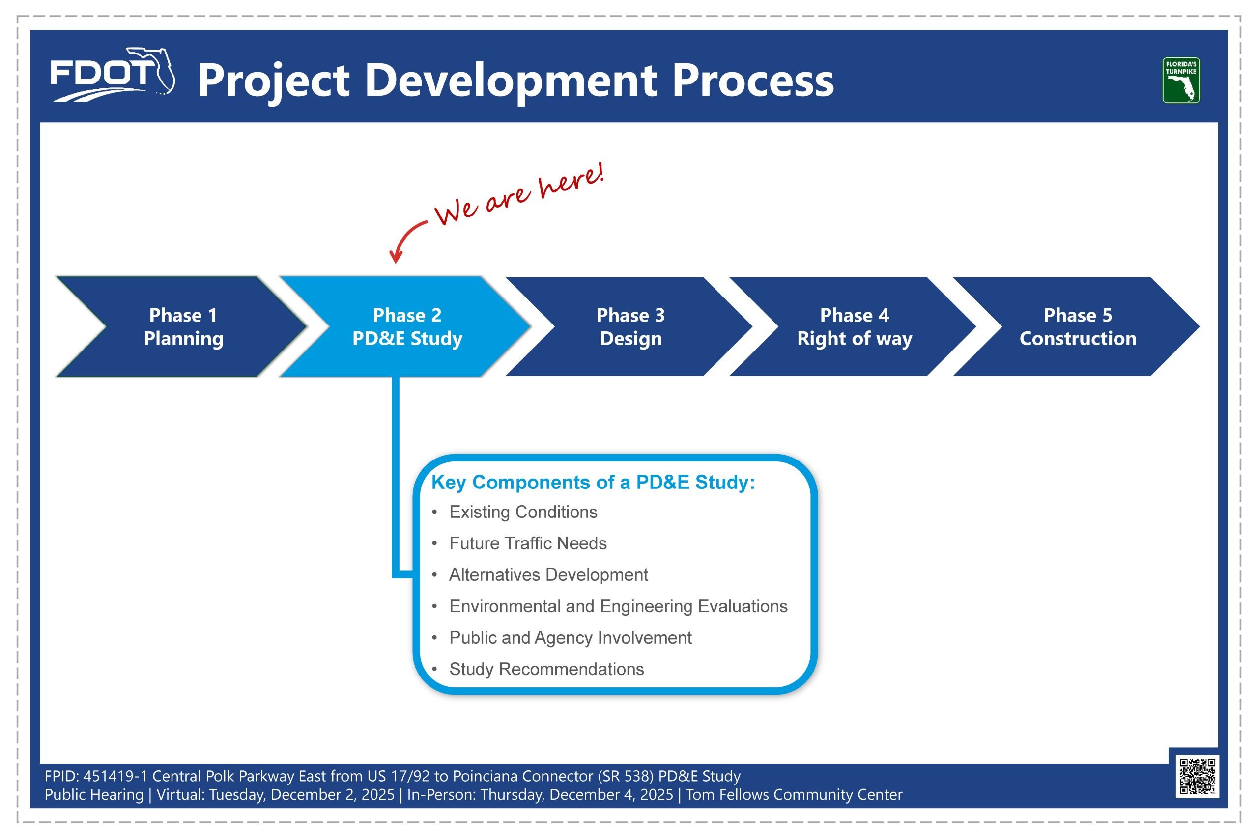
A PD&E Study is the second phase of FDOT’s Project Development Process. It determines the environmental effects associated with a proposed transportation project. Key components of a PD&E Study include an evaluation of existing conditions, identification of future traffic needs, alternatives development, and evaluation of the alternatives based on environmental and engineering factors. An important component of the PD&E process is public and agency involvement. All findings and recommendations are documented at the end of the study. If a build alternative is selected, then the project moves forward into the design phase when funds become available.
- Virtual Public Hearing Video
- Project Development Process
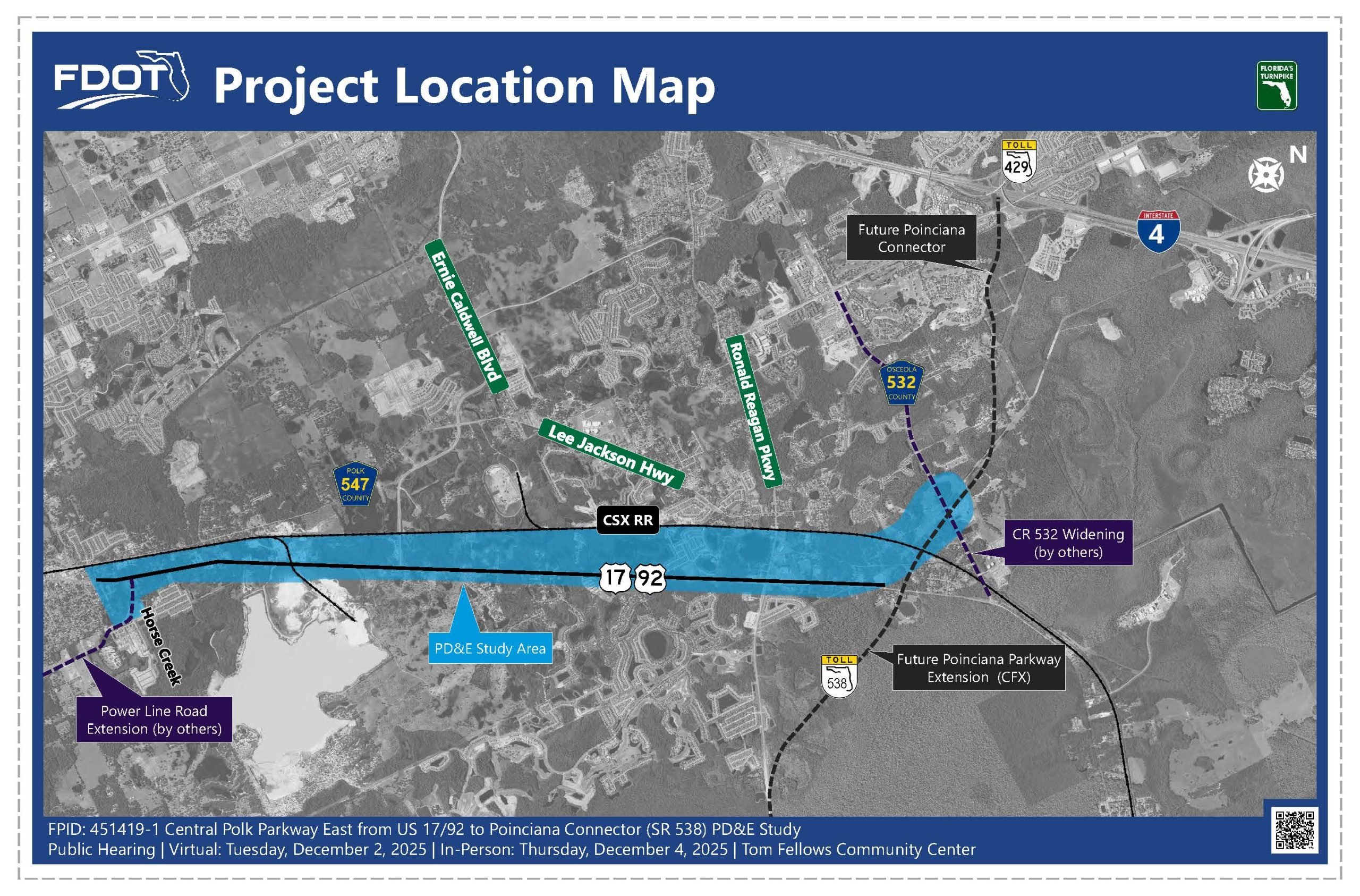
- Project Location Map
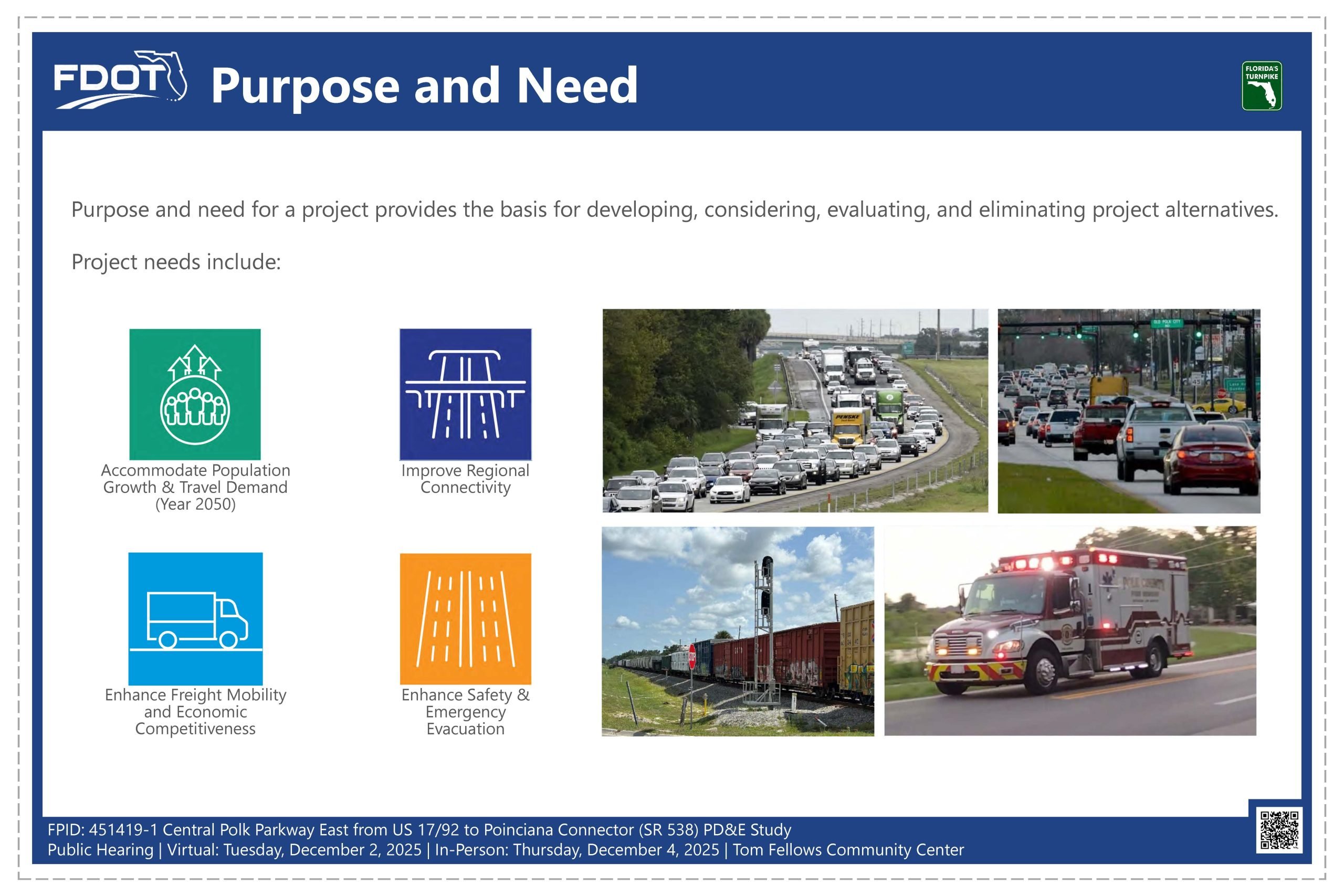
- Purpose and Need
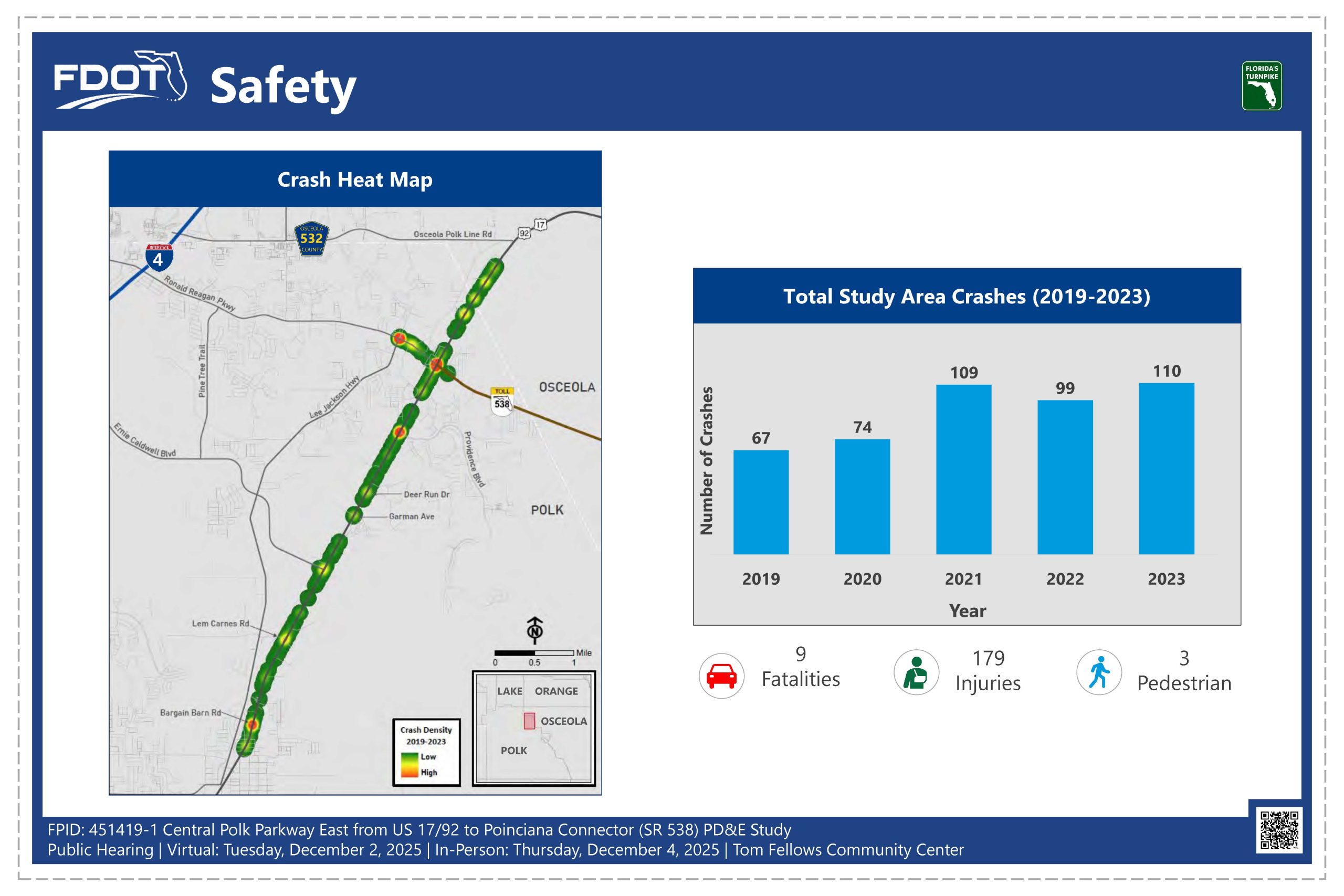
- Safety
- Typical Sections
- Preferred Alternative – Sheet 1 of 3
- Preferred Alternative – Sheet 2 of 3
- Preferred Alternative – Sheet 3 of 3
- Photo Simulations
- Evaluation Matrix
- PD&E Study Schedule
- Regional Projects
- Contact
- Title 6 Compliance
The study area is in northeast Polk County. The study limits begin on US 17/92, south of the Power Line Road Extension, and extend approximately seven miles northeast to the future Poinciana Connector, which is under design and will connect Poinciana Parkway (SR 538) to SR 429. The CSX rail line borders the study area on the west side.
The purpose and need for a project provides the basis for developing, considering, evaluating, and eliminating project alternatives. The need for the Central Polk Parkway East include accommodating population growth and the associated travel demands, improving regional connectivity and overall system linkage, enhancing freight mobility and economic competitiveness, and enhancing safety, emergency evacuation and response.
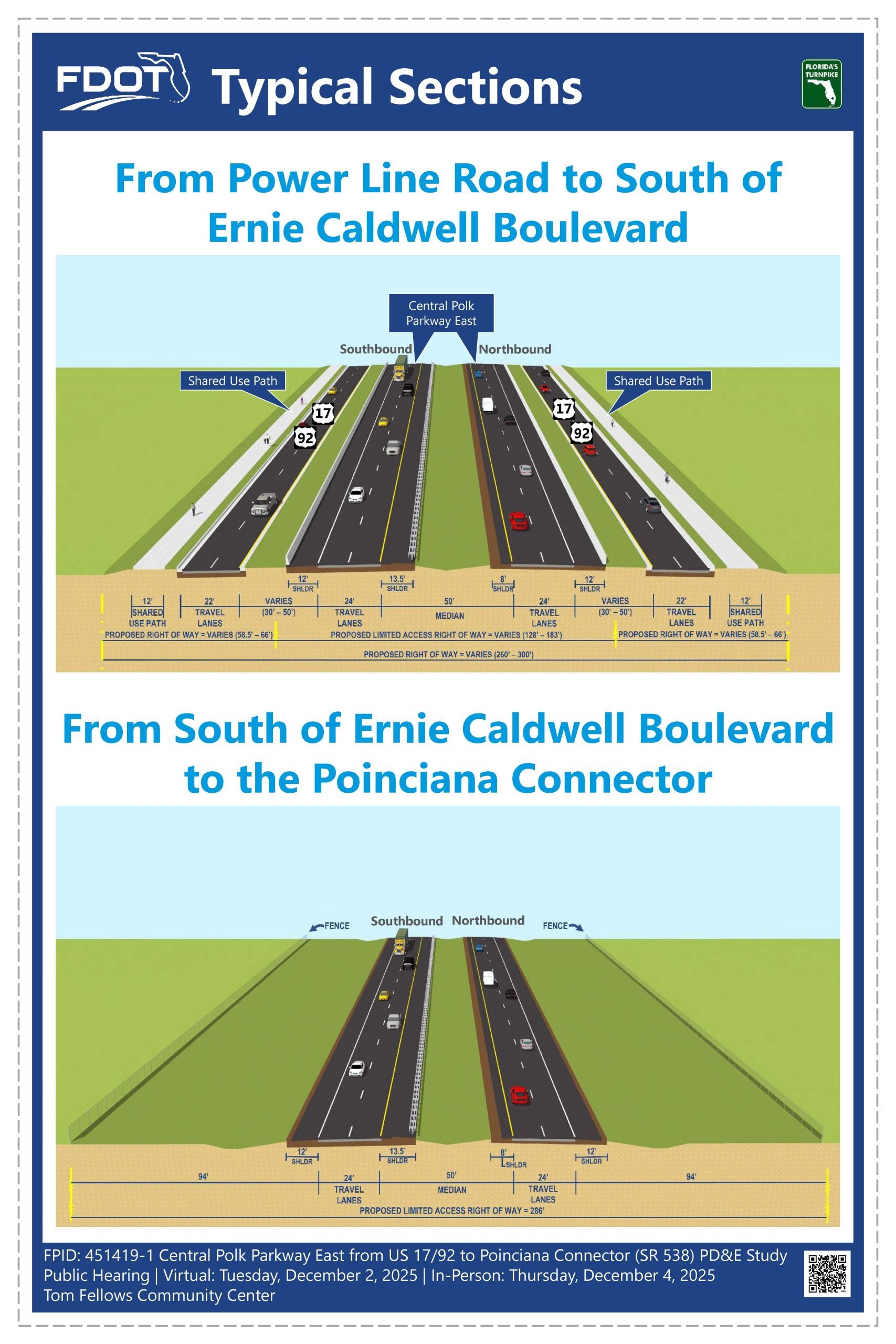
From Power Line Road to just south of Ernie Caldwell Boulevard, the proposed design uses a co-located typical section. This means Central Polk Parkway East will run as a four-lane limited access highway, while US 17/92 will be rebuilt as a four-lane frontage road. This design maintains safe access to nearby properties and supports local traffic.
Shared-use paths will be added on both sides of the road to accommodate bicyclists and pedestrians. The current right-of-way for US 17/92 is 100 feet, and the proposed right-of-way will range from 260 to 300 feet.
From just south of Ernie Caldwell Boulevard to the Poinciana Connector, the project shifts to a new alignment typical section. This includes a four-lane limited access highway with two 12-foot lanes in each direction, separated by a 50-foot median. Shoulders of varying widths will be included, following FDOT design standards. The total right-of-way for this section will be 286 feet.
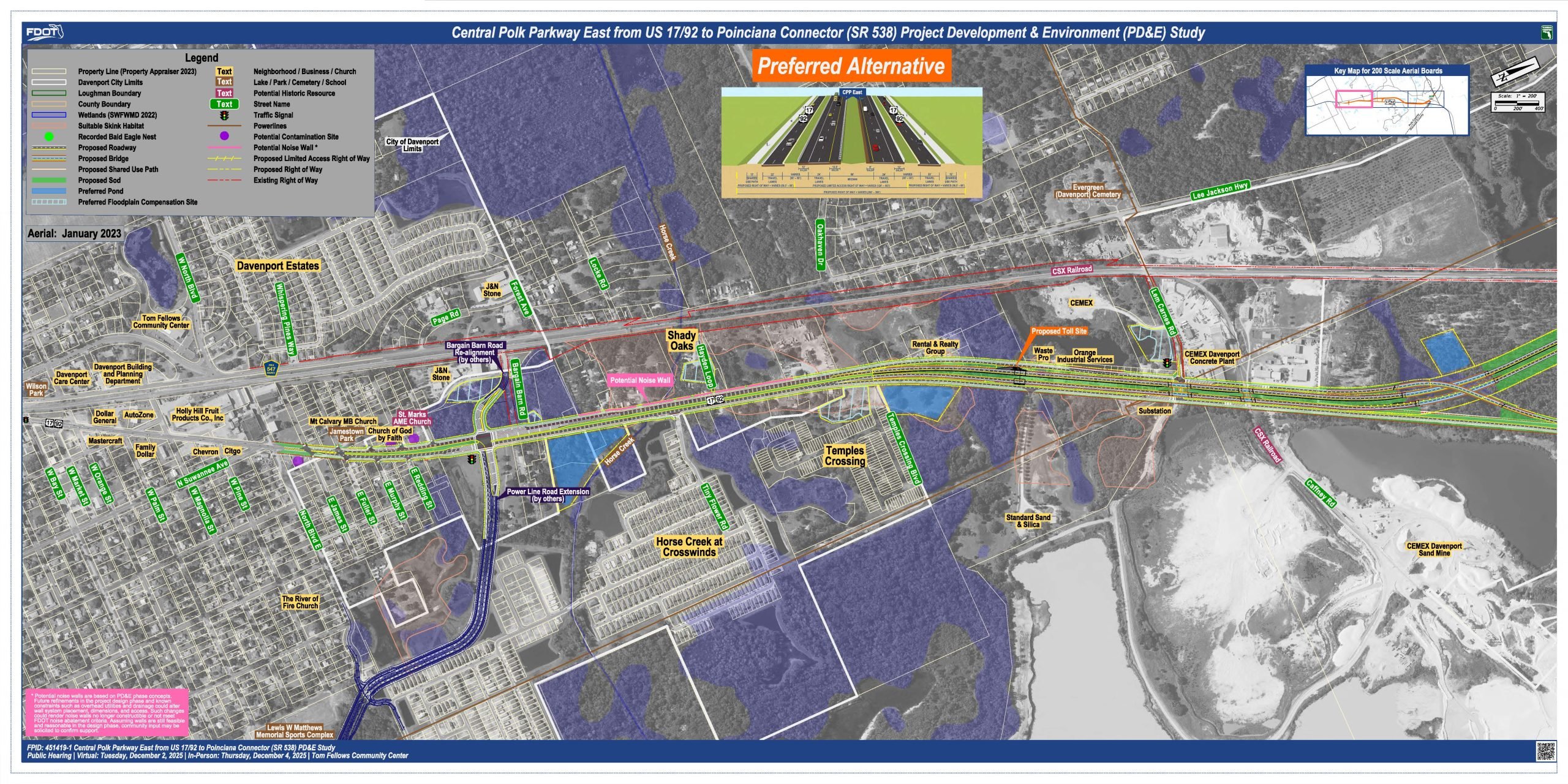
This exhibit shows Segment 1, with north to the right. The proposed improvements would start on US 17/92, north of James Street and continue to the north along US 17/92. Bargain Barn Road would be realigned to join the Power Line Road intersection. Access to and from the proposed highway would occur north of Power Line Road, after which the highway would be co-located with US 17/92 for a short distance.
This highway separates from US 17/92 north of Lem Carnes Road. The highway would bridge over Lem Carnes Road, the CSX railroad spur, the southbound US 17/92 lanes and wetlands. Meanwhile, US 17/92 will remain at ground level. To build the new highway, additional right-of-way will be needed on both sides of US 17/92.
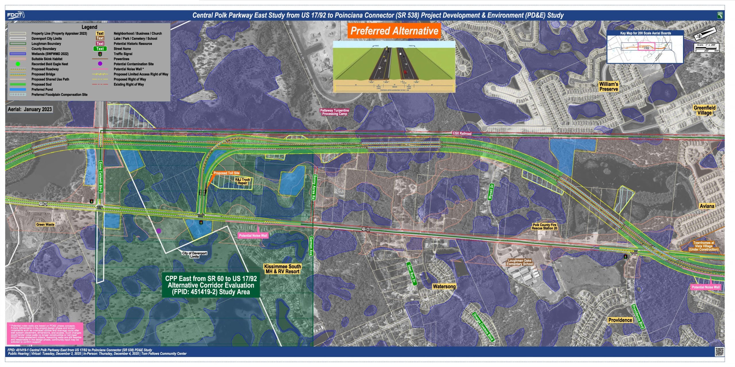
This exhibit shows Segment 2, with north to the right. The highway would continue in a northwest direction until it runs parallel to the CSX railroad. It would then cross back to the east of US 17/92 north of Providence Blvd. Access to and from the highway is provided north of Ernie Caldwell Blvd. Interchange ramps will serve northbound-on and southbound off access, and US 17/92 would be widened to two lanes in each direction north of the interchange ramps.
Improvements to US 17/92 to accommodate bridge piers as the highway crosses over US 17/92 would be required at Providence Blvd. The remainder of US 17/92 in Segment 2 will remain in the existing condition. This alternative does not impact Loughman Oaks Elementary School or the Polk County fire station. The highway will bridge over water bodies, wetlands, and US 17/92. Drivers will still be able to turn left into and out of the Providence community. Additional right-of-way will be needed to build the new highway.
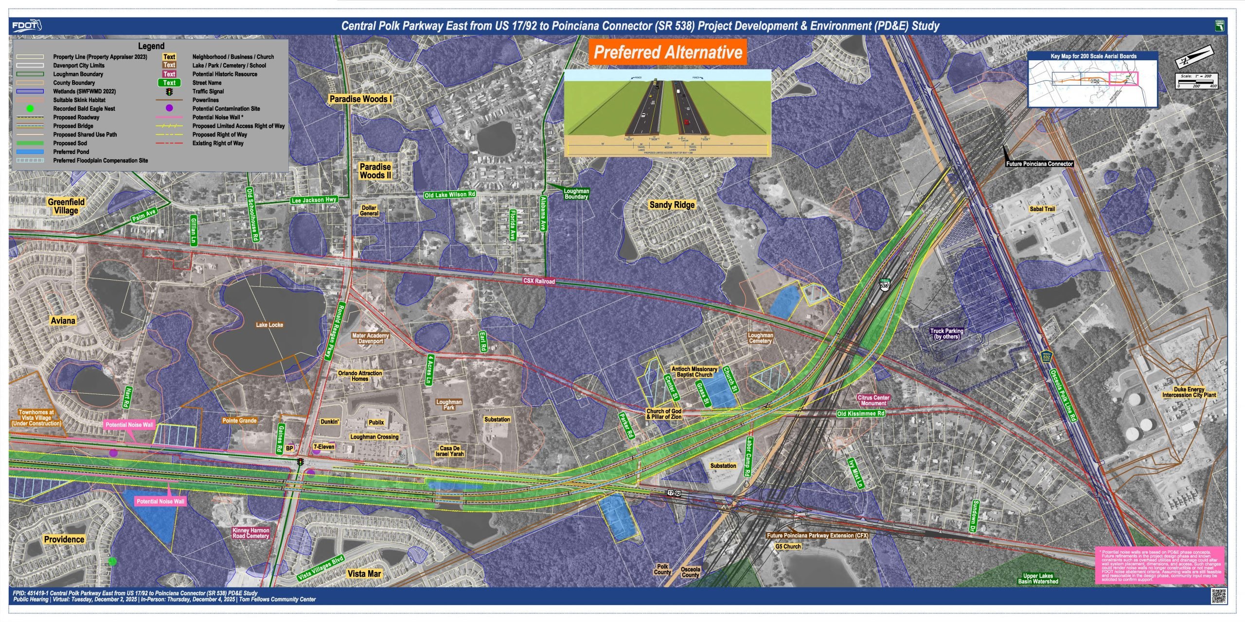
This exhibit shows Segment 3, with north to the right. The highway continues separate to US 17/92 to Poinciana Parkway. North of Ronald Reagan Parkway, US 17/92 is widened to two travel lanes in each direction. This project ends on US 17/92 just before a future Poinciana Parkway interchange that will be completed by the Central Florida Expressway Authority.
The highway will bridge over Ronald Reagan Parkway, a water body, US 17/92, Old Kissimmee Road, the CSX railroad, and the future Poinciana Parkway. Additional right-of-way will be needed to build the new highway.
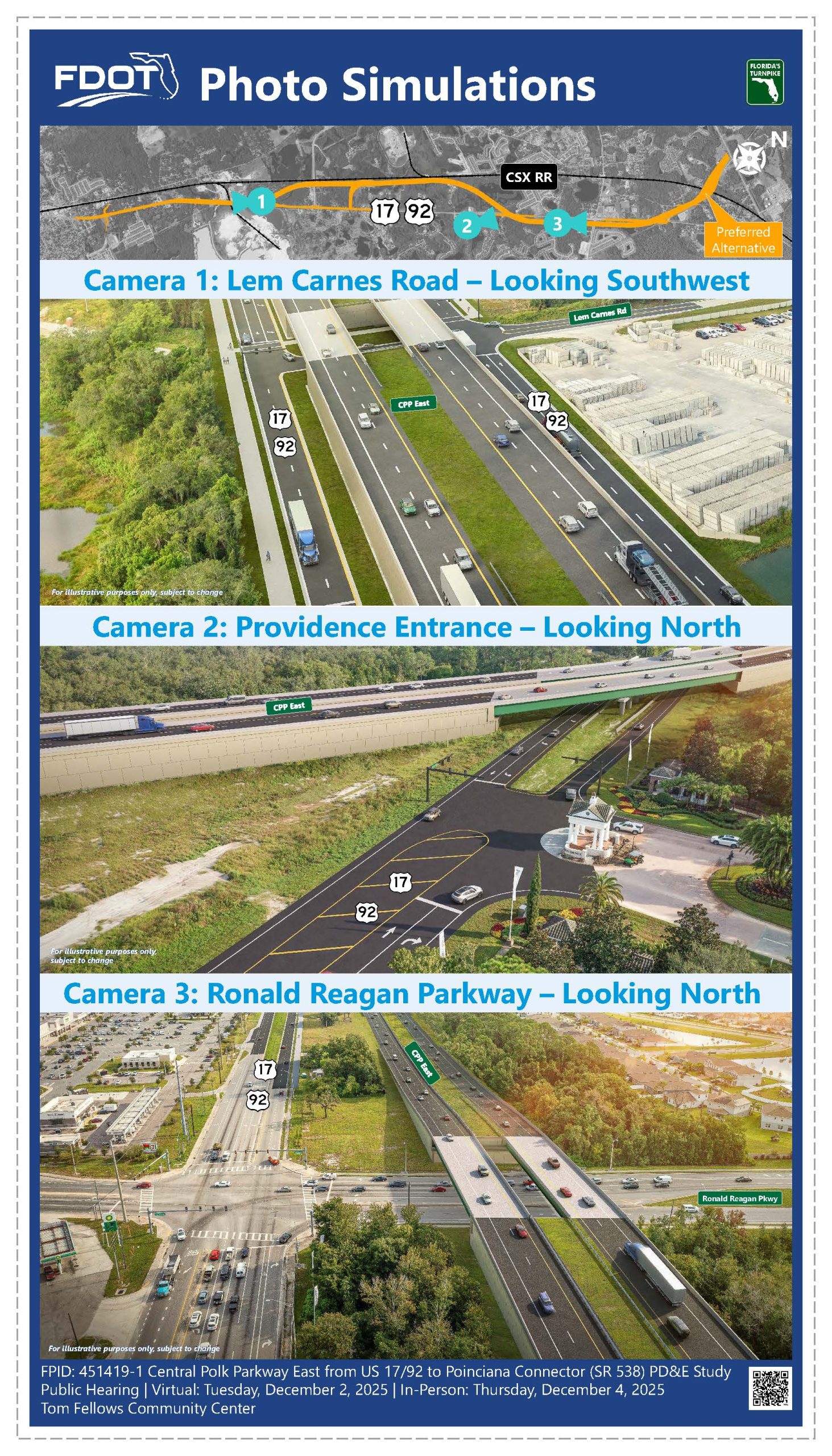
These photo simulations illustrate potential views of the proposed improvements for Central Polk Parkway (CPP) East:
- Lem Carnes Road Area:
The first simulation shows CPP East running alongside US 17/92 near Lem Carnes Road. CPP East will pass over Lem Carnes Road, while US 17/92 will remain at ground level with a signalized intersection. - Providence Community Entrance:
The second image looks northwest toward the entrance of the Providence Community. Access at Providence Boulevard will remain unchanged by the proposed improvements. - Ronald Reagan Parkway Crossing:
The third simulation shows a northward view of the proposed overpass where CPP East crosses Ronald Reagan Parkway. In this area, CPP East is positioned to the east of US 17/92.
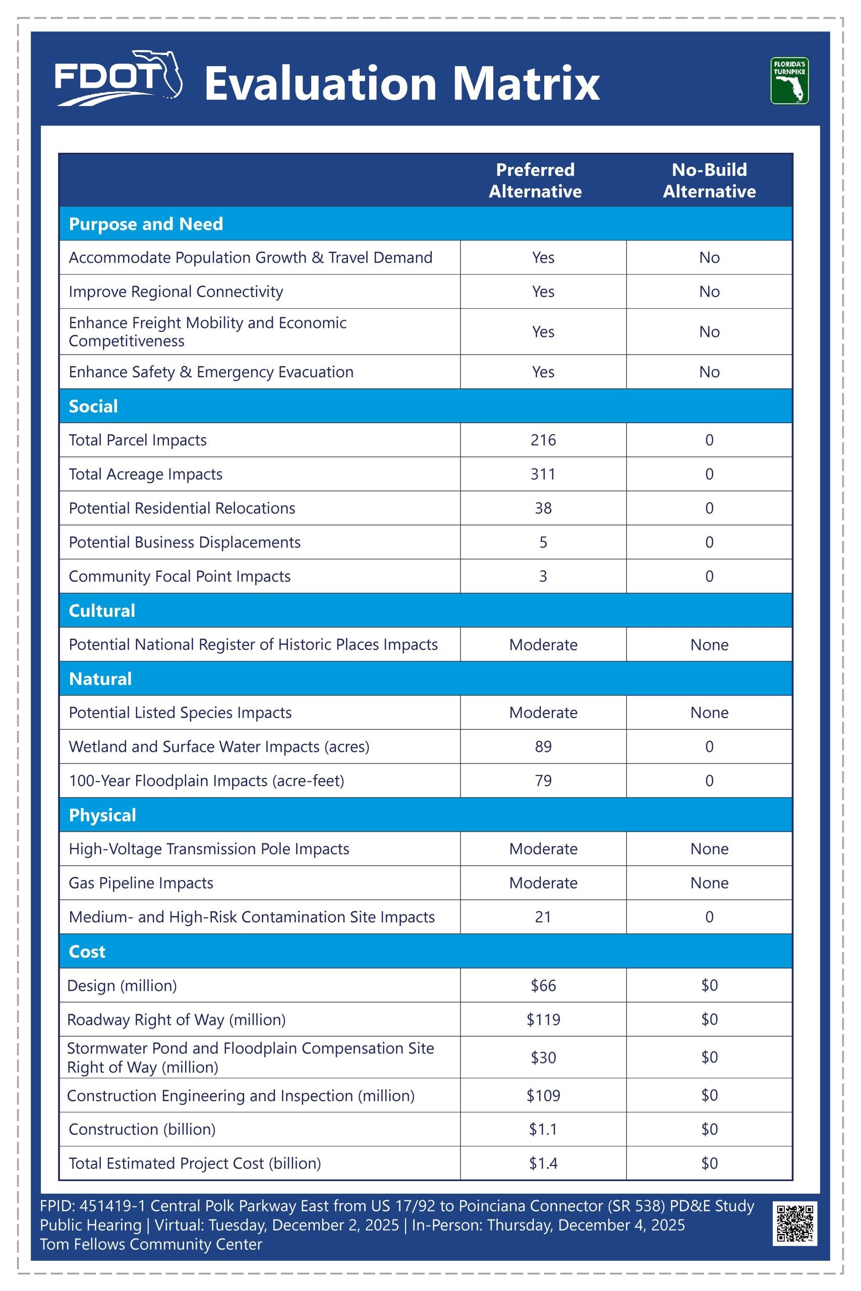
This evaluation matrix presents the potential impacts and costs associated with the Preferred and No-Build Alternative. While the Preferred Alternative meets the project purpose and need, it will result in impacts to study area features. Although the No-Build Alternative does not require impacts to any study area features or require substantial funding commitments, it does not meet the project purpose and need.
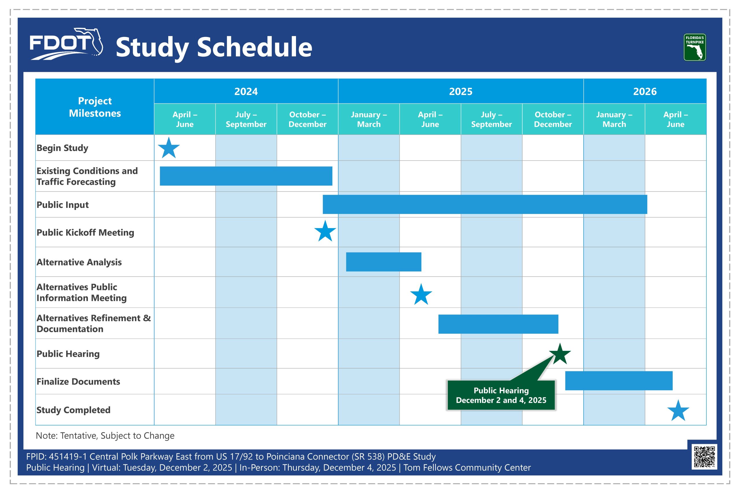
The PD&E study began in the spring of 2024 and included a Public Kickoff Meeting in December 2024 and an Alternatives Public Information Meeting in April 2025. The study’s final recommendations are being presented at this Public Hearing before the study’s completion in the first quarter of 2026. Please note that this schedule is subject to change.
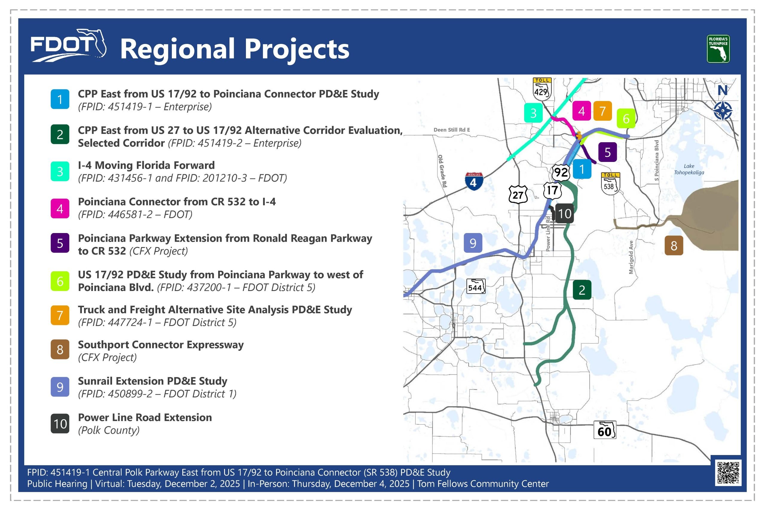
There are several on-going PD&E, design, and construction projects within and adjacent to the limits of this PD&E study to serve the growing regional travel demands. Important projects to note include the Central Polk Parkway East from State Road 60 to US 17 92 Alternative Corridor Evaluation Study, or ACE, which is being conducted just south of this project, the I-4 Moving Florida Forward project, and the Poinciana Connector.
This project is being developed in accordance with the Civil Rights Act of 1964. Under Title 6 of the Civil Rights Act, public participation is solicited without regard to race, color, national origin, age, sex, religion, disability, or family status. Please contact one of the Title 6 coordinators shown here to express any concerns regarding Florida Turnpike’s compliance with Title 6.
If you would like to make a comment regarding the study, please use one of the methods described here.

