WELCOME!

The Florida Department of Transportation, Florida’s Turnpike Enterprise, welcomes you to the Public Information Meeting for the Central Polk Parkway, from US 17 (SR 35) to SR 60 in Polk County.

Please use the navigation menu below to view the public information meeting  materials. Clicking on the graphic will enlarge the view.

To provide a comment, click on the “View Comment Form” button shown below. Complete your comment and click “Submit.” We look forward to receiving your input.

The Florida Department of Transportation, Florida’s Turnpike Enterprise, welcomes you to the Public Information Meeting for the Central Polk Parkway, from US 17 (SR 35) to SR 60 in Polk County.

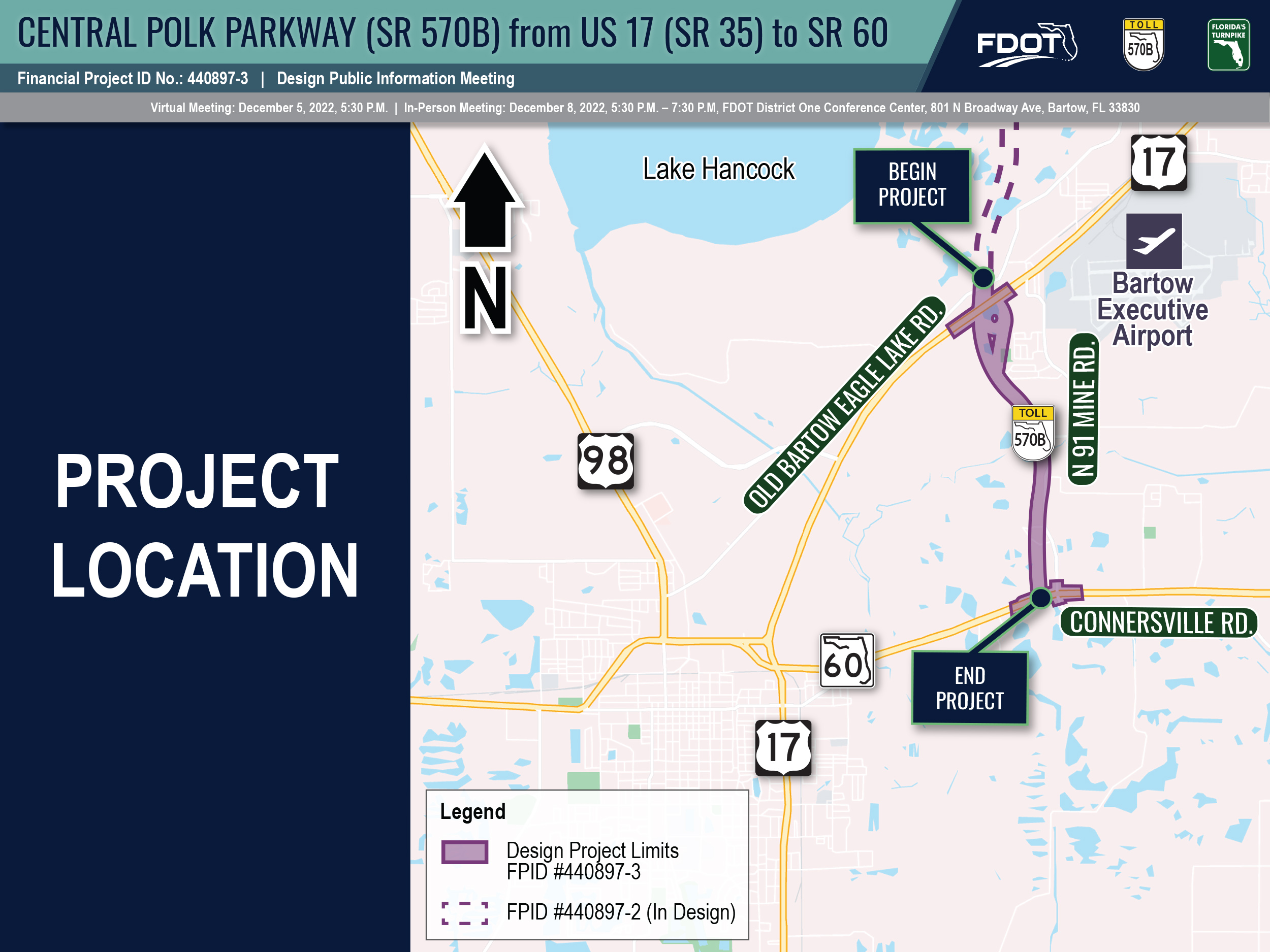
The limits of this project are from US 17 (SR 35) to SR 60. The length of the project is approximately 2.5 miles. This graphic is available for download on the main project webpage under the “Documents” section. 

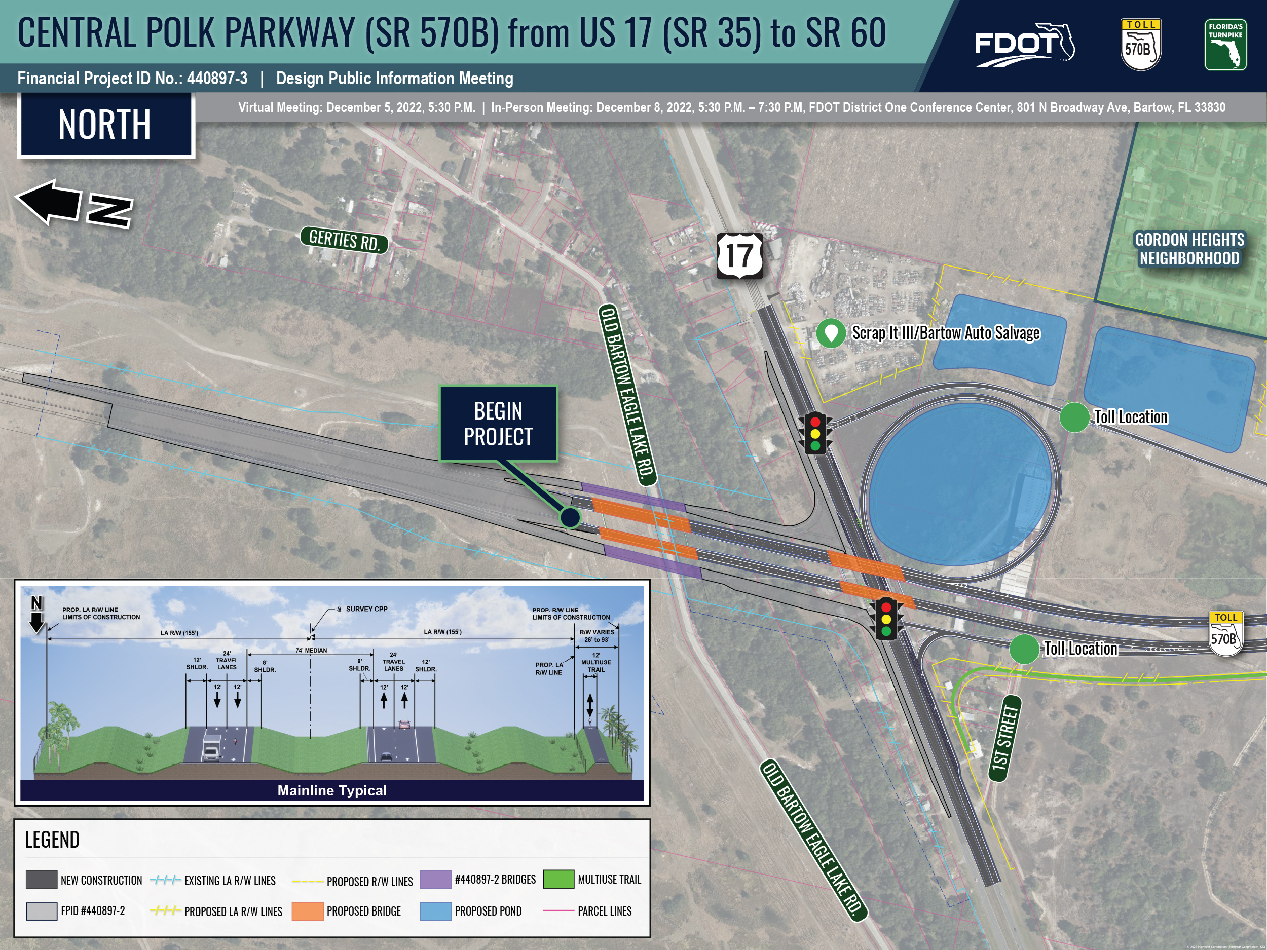
The proposed design for the project is displayed on three separate boards: Northern, Central, and Southern. The Northern Exhibit depicts the improvements near US 17, including the proposed interchange, as well as the proposed typical section that applies to the whole project. This exhibit also includes the locations of the proposed toll locations along the ramps south of US 17 and the connection with the project to the north, which constructs the Central Polk Parkway (SR 570B) from Polk Parkway (SR 570) to US 17 (SR 35). This graphic is available for download on the main project webpage under the “Documents” section. 

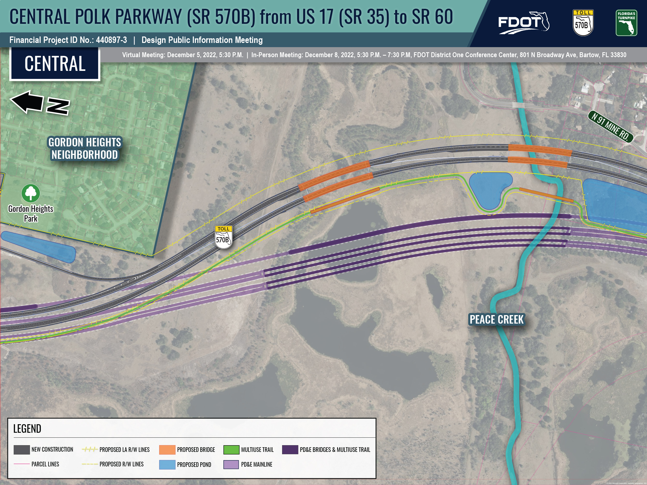
The proposed design for the project is displayed on three separate boards: Northern, Central, and Southern. The Central Exhibit depicts the improvements between US 17 and SR 60, primarily including the bridges over formerly mined phosphate lands and Peace Creek. This graphic is available for download on the main project webpage under the “Documents” section. 

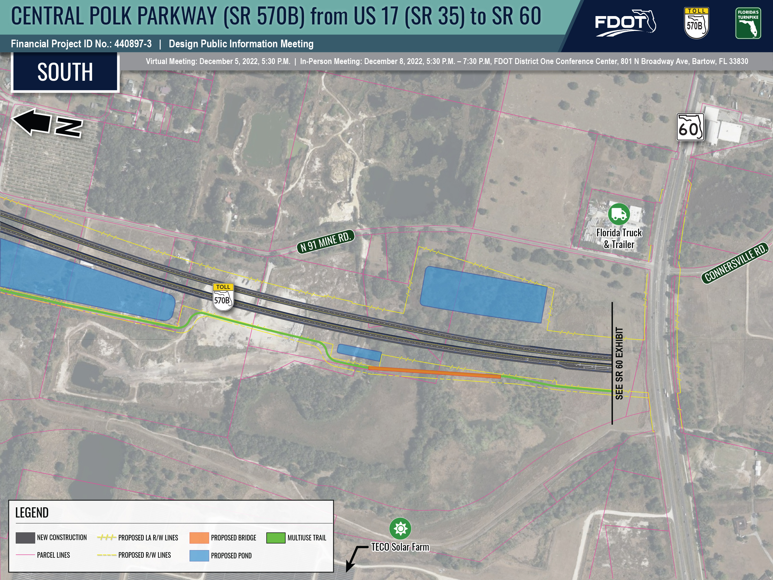
The proposed design for the project is displayed on three separate boards: Northern, Central, and Southern. The Southern Exhibit depicts the improvements approaching SR 60. This graphic is available for download on the main project webpage under the “Documents” section. 

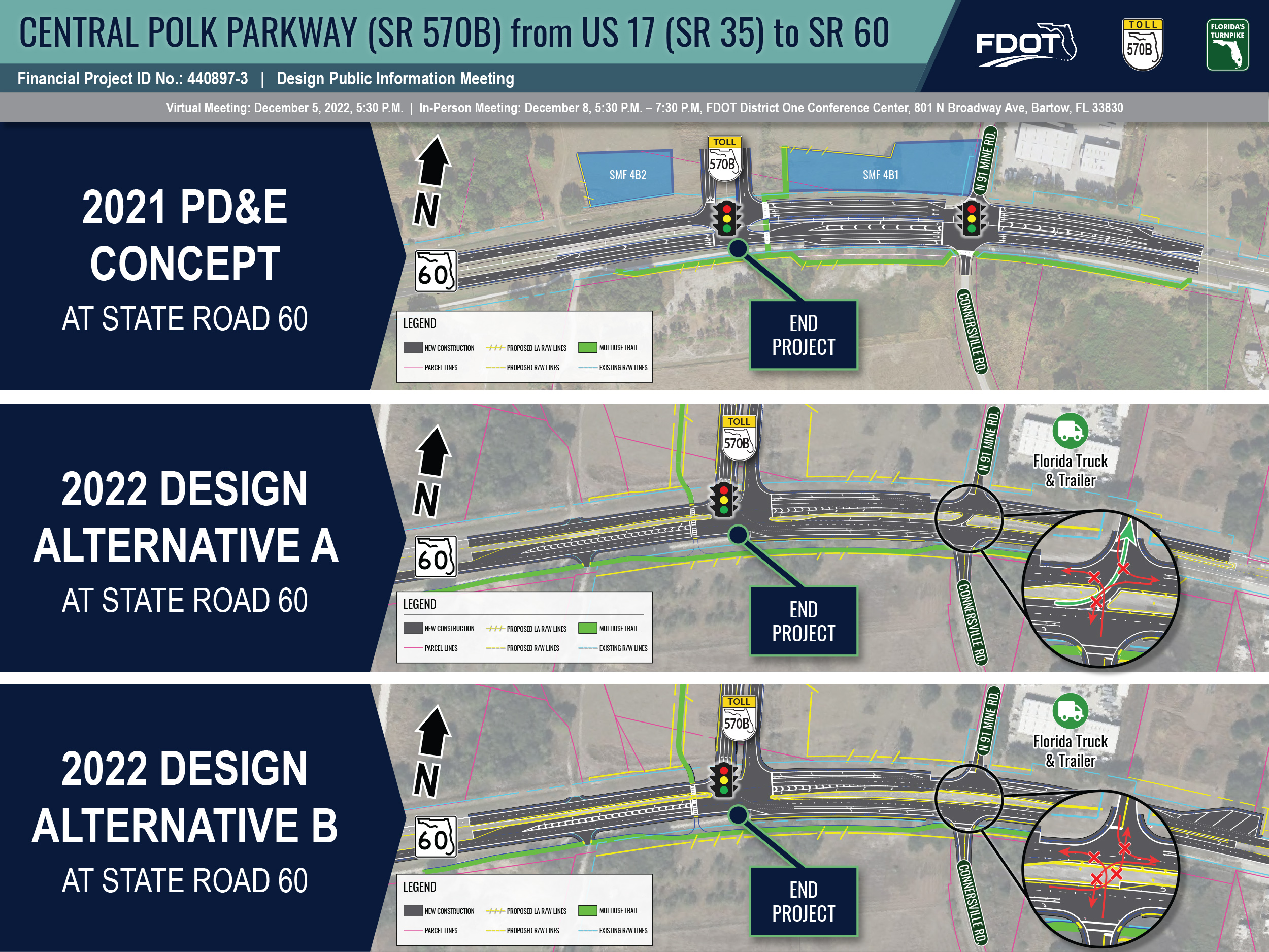
The changes in the design along SR 60, as compared to the PD&E concept, are compared in this exhibit. Two alternatives are presented that include the elimination of the signal and changes in allowable turning movements at 91 Mine Road/Connersville Road. This graphic is available for download on the main project webpage under the “Documents” section. 

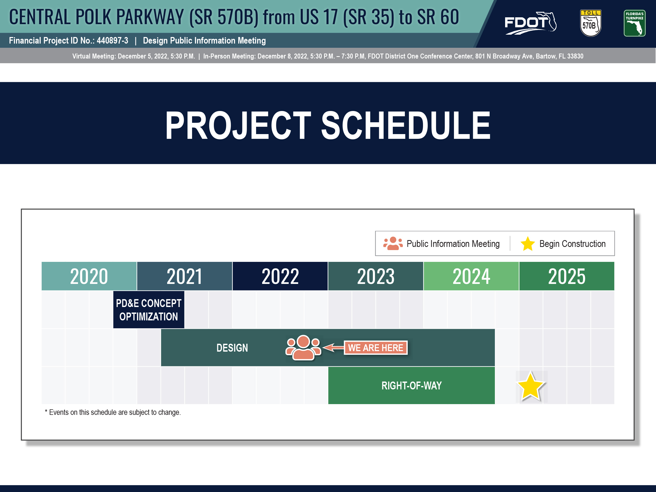
The design of the Central Polk Parkway was started by the Florida’s Turnpike Enterprise in the second quarter of 2021 and is scheduled for completion in the fourth quarter of 2024. Right-of-way acquisition is scheduled to begin in early 2023 and be completed by the fourth quarter of 2024. Construction is anticipated to begin in the first quarter of 2025. This graphic is available for download on the main project webpage under the “Documents” section. 

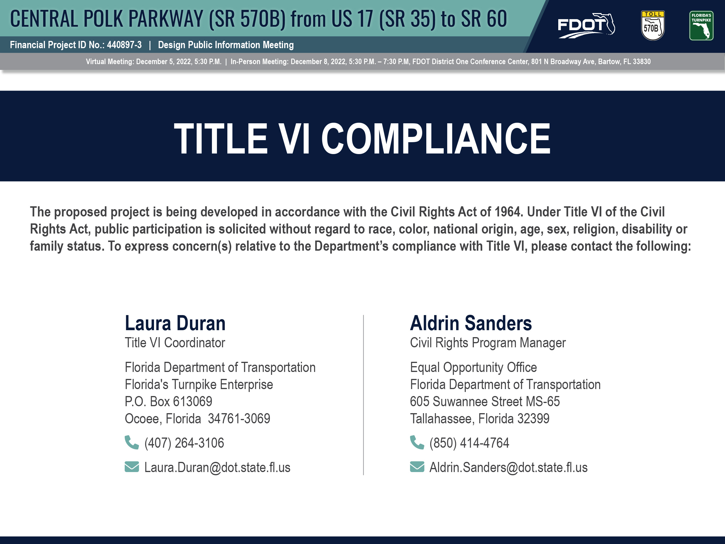
Persons wishing to express their concerns about Title VI compliance may do so by contacting either the Florida’s Turnpike Enterprise, or the Tallahassee office of the Florida Department of Transportation. This graphic is available for download on the main project webpage under the “Documents” section. 

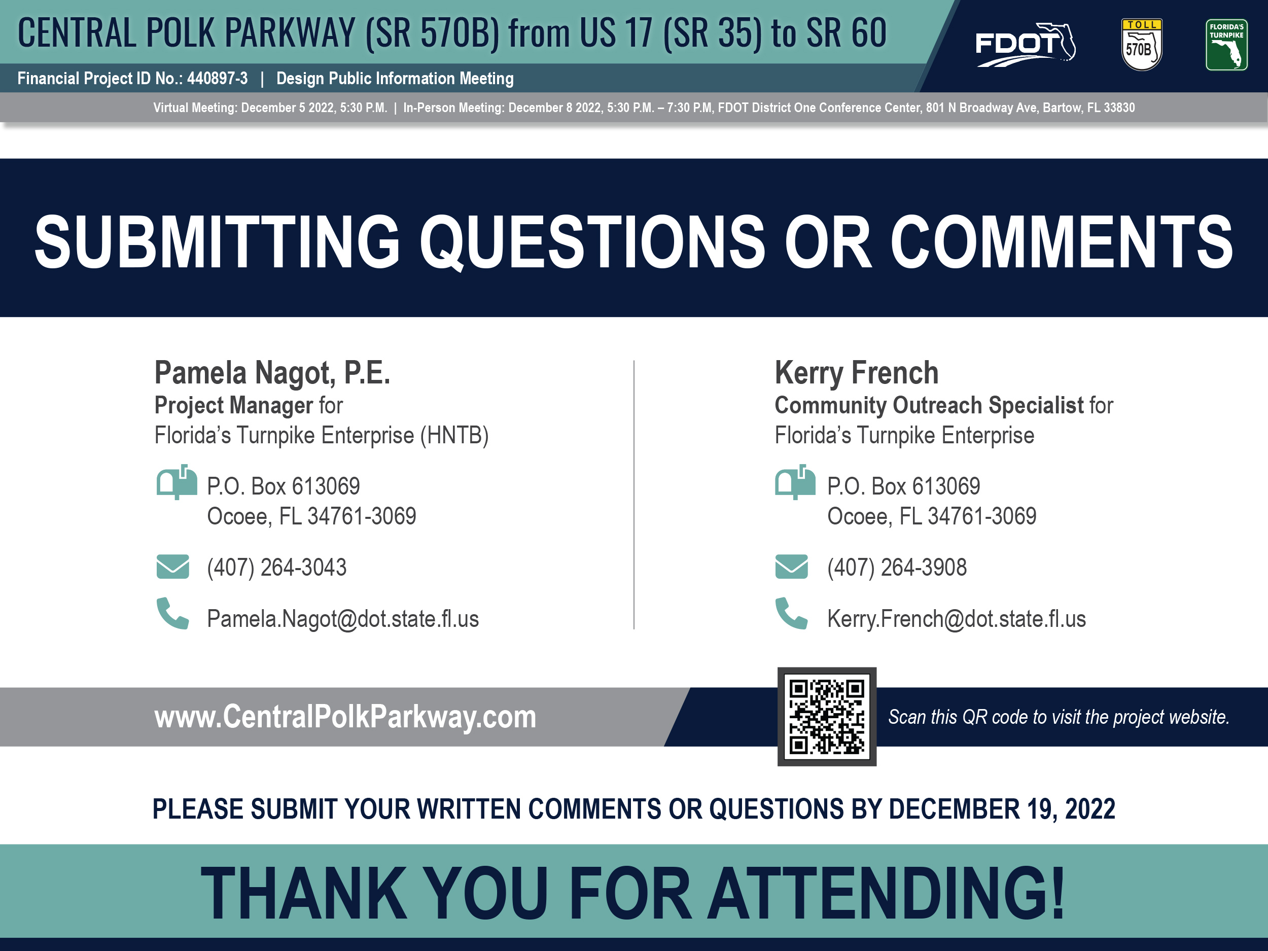
We encourage your questions or comments regarding this project! Please contact one of the individuals shown here, using your preferred method. Comments and questions must be submitted (or postmarked) by December 19, 2022 to become part of the Design Public Information Meeting Record. This graphic is available for download on the main project webpage under the “Documents” section. 

COMMENT FORM