The Florida Department of Transportation, Florida’s Turnpike Enterprise welcomes you to the Alternatives Public Information Meeting for the Project Development and Environment (PD&E) Study for the widening of Florida’s Turnpike Mainline, State Road 91, from North of State Road 60 to South of Clay Whaley Road, in Osceola County, Financial Project Identification Number 423374-3.
Public Information Meeting: 423374 3 Widen Turnpike PD&E Study from SR 60 to Clay Whaley Rd
This project is being developed in accordance with the Civil Rights Act of 1964. Under Title VI of the Civil Rights Act, public participation is solicited without regard to race, color, national origin, age, sex, religion, disability, or family status. Please contact one of the Title VI coordinators shown here to express any concerns regarding Florida Turnpike’s compliance with Title VI.
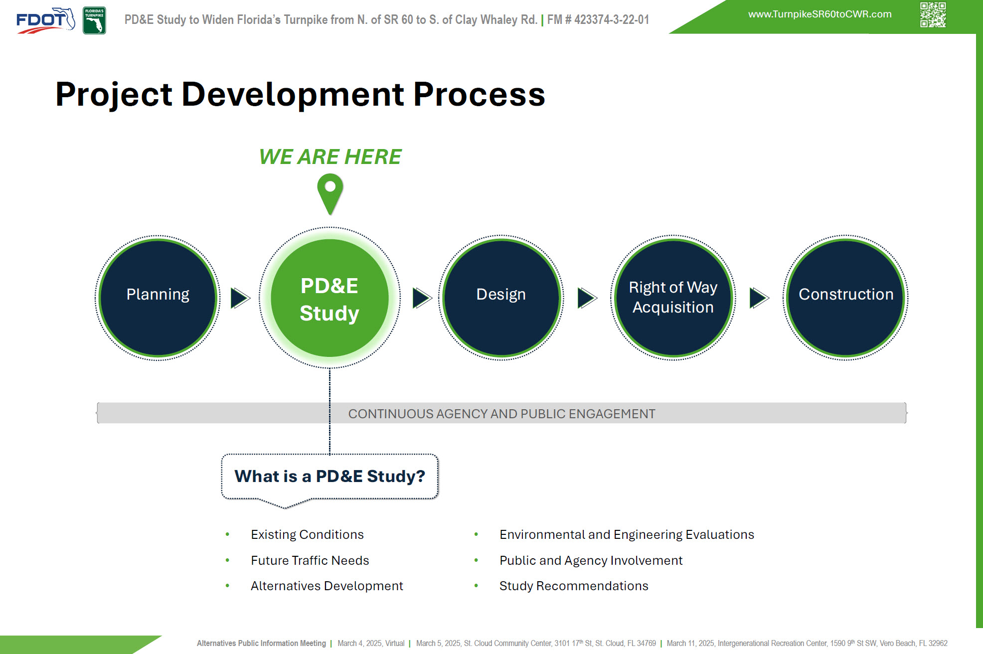
The PD&E Study is ongoing and is the second phase of FDOT’s Transportation project development process. Key components of the PD&E Study include an evaluation of existing conditions, identification of future traffic needs, development and evaluation of project alternatives, and public and agency involvement. All findings and recommendations are documented at the end of the study. Subsequent phases include final design and engineering, right of way acquisition, when needed, and construction. Right of way acquisition is not anticipated for this project. The subsequent phases are currently not funded but will be considered for funding upon the completion of the PD&E Study.
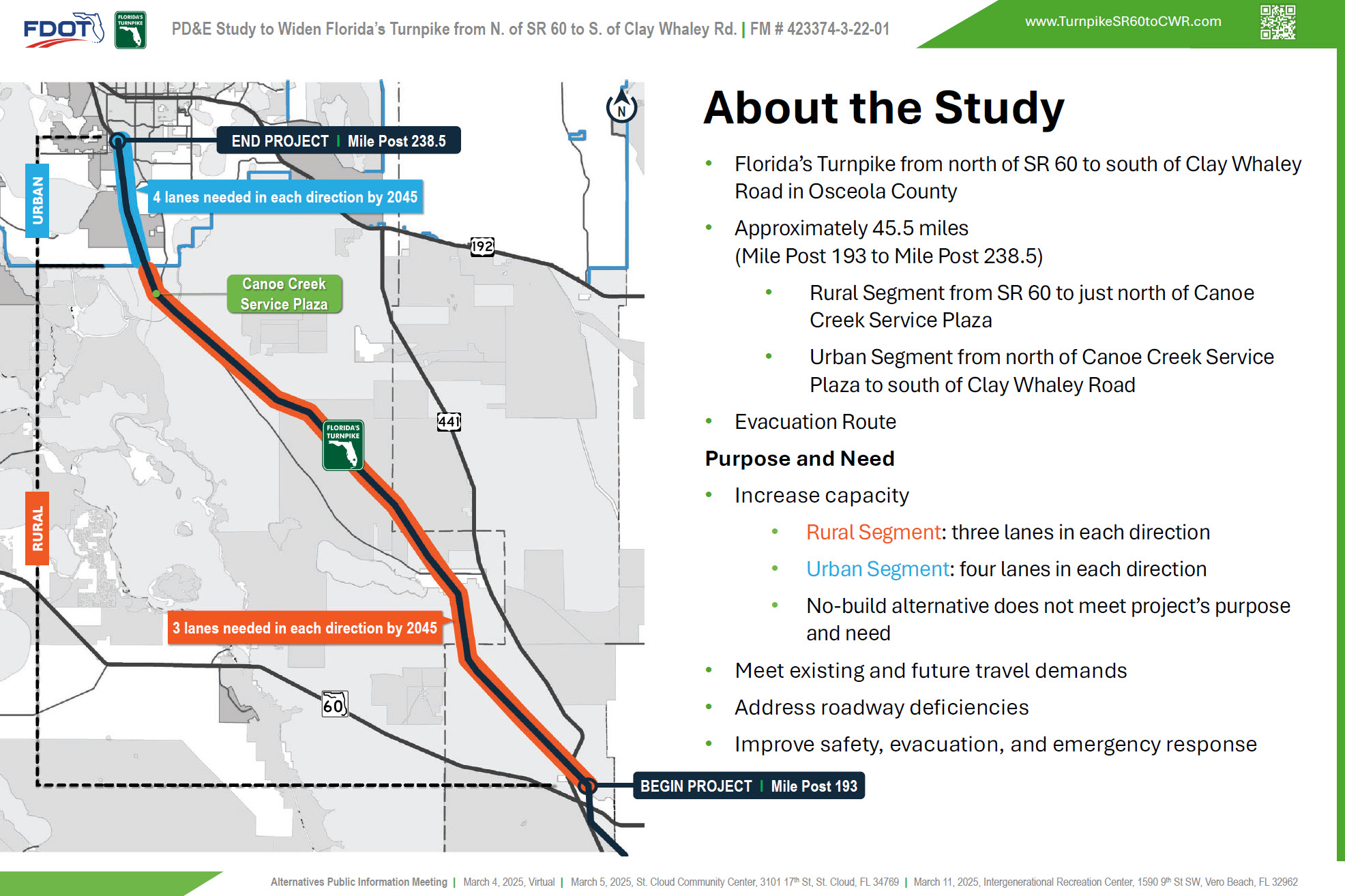
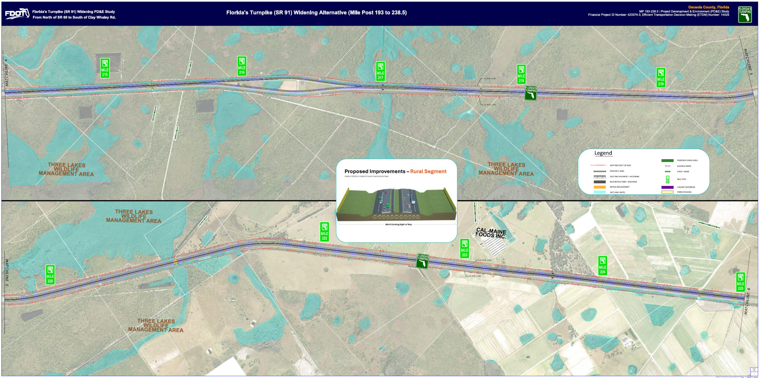
This Turnpike PD&E Study is located in Osceola County. The project begins north of SR 60 and continues to south of Clay Whaley Road, from milepost 193 to 238.5, a distance of approximately 45.5 miles. The segment from SR 60 to just north of the Canoe Creek Service Plaza is primarily rural, transitioning to an urban setting toward the project’s endpoint. This section of the mainline features the Canoe Creek Service Plaza, passes through the Three Lakes Wildlife Management Area, and serves as a critical evacuation route for Florida.
The purpose and need for this study are to increase capacity, meet existing and future travel demands, address roadway deficiencies, and improve safety, evacuation, and emergency response. An increase in capacity is needed to accommodate projected traffic volumes. In the rural segment, three lanes in each direction will be needed by 2045, and in the urban segment, four lanes in each direction will be needed by 2045 to meet traffic demands. The no-build alternative does not meet the project’s purpose and need
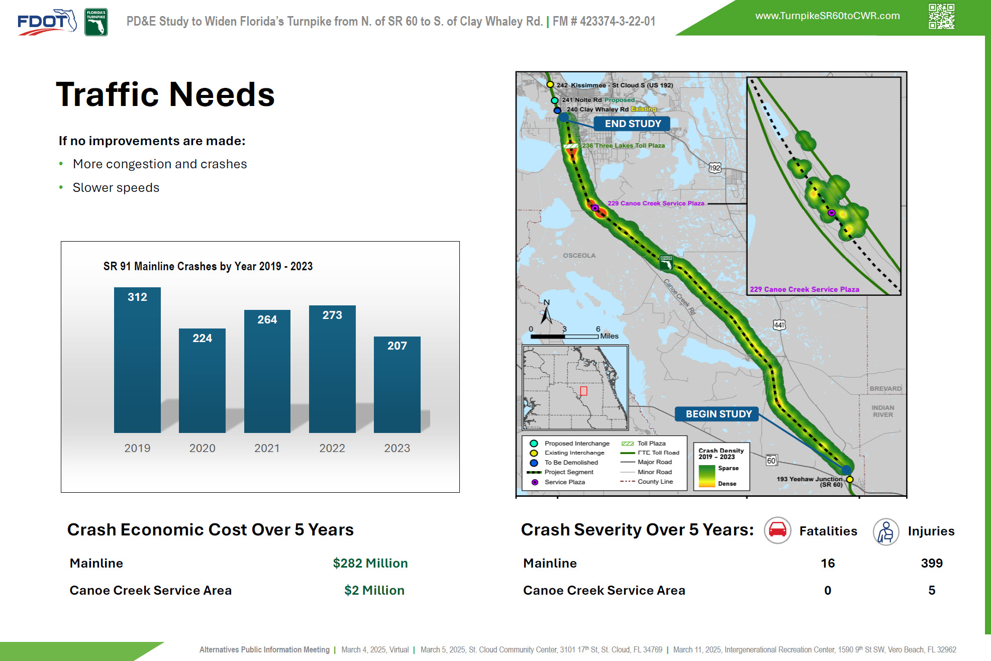
If no improvements are made, an increase in the travel demand could result in more congestion and crashes. Between years 2019 to 2023, there were 1,280 crashes along the Florida’s Turnpike Mainline which resulted in 16 fatalities and 399 injuries within the study limits. A total of 45 crashes were also reported within the vicinity of the Canoe Creek Service Area. The total crashes estimated economic cost within the study limit was about 284 million dollars between years 2019 to 2023.
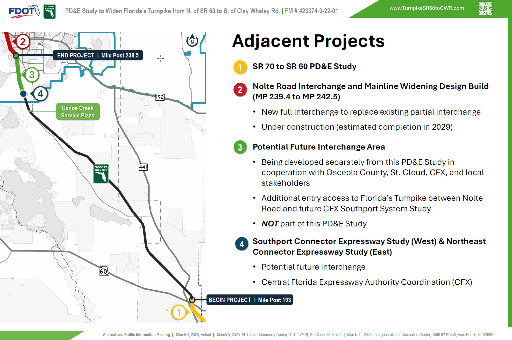
This PD&E Study is part of a larger network of improvement projects spanning both north and south of the project limits. Ongoing coordination with adjacent projects has been maintained and will continue throughout the duration of the study. This includes collaboration with the current PD&E study to the south, coordination with the Nolte Road Interchange Design Build team, and a separate concept study that will analyze and document the potential location of a future interchange between Nolte Road and the future CFX interchange. Additionally, multiple coordination efforts have taken place with the Central Florida Expressway Authority regarding the potential future interchange for the Southport and Northeast Connector.
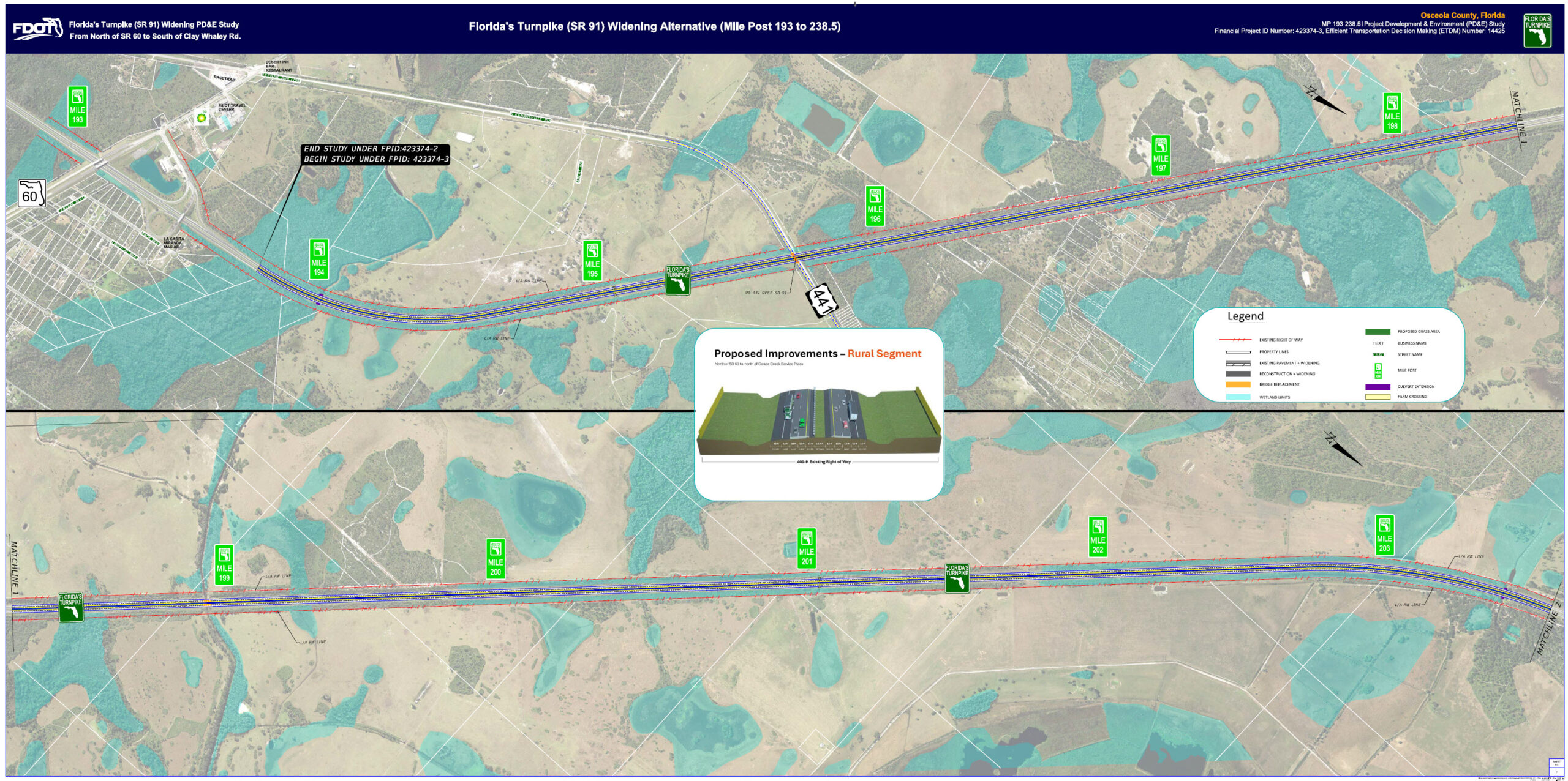
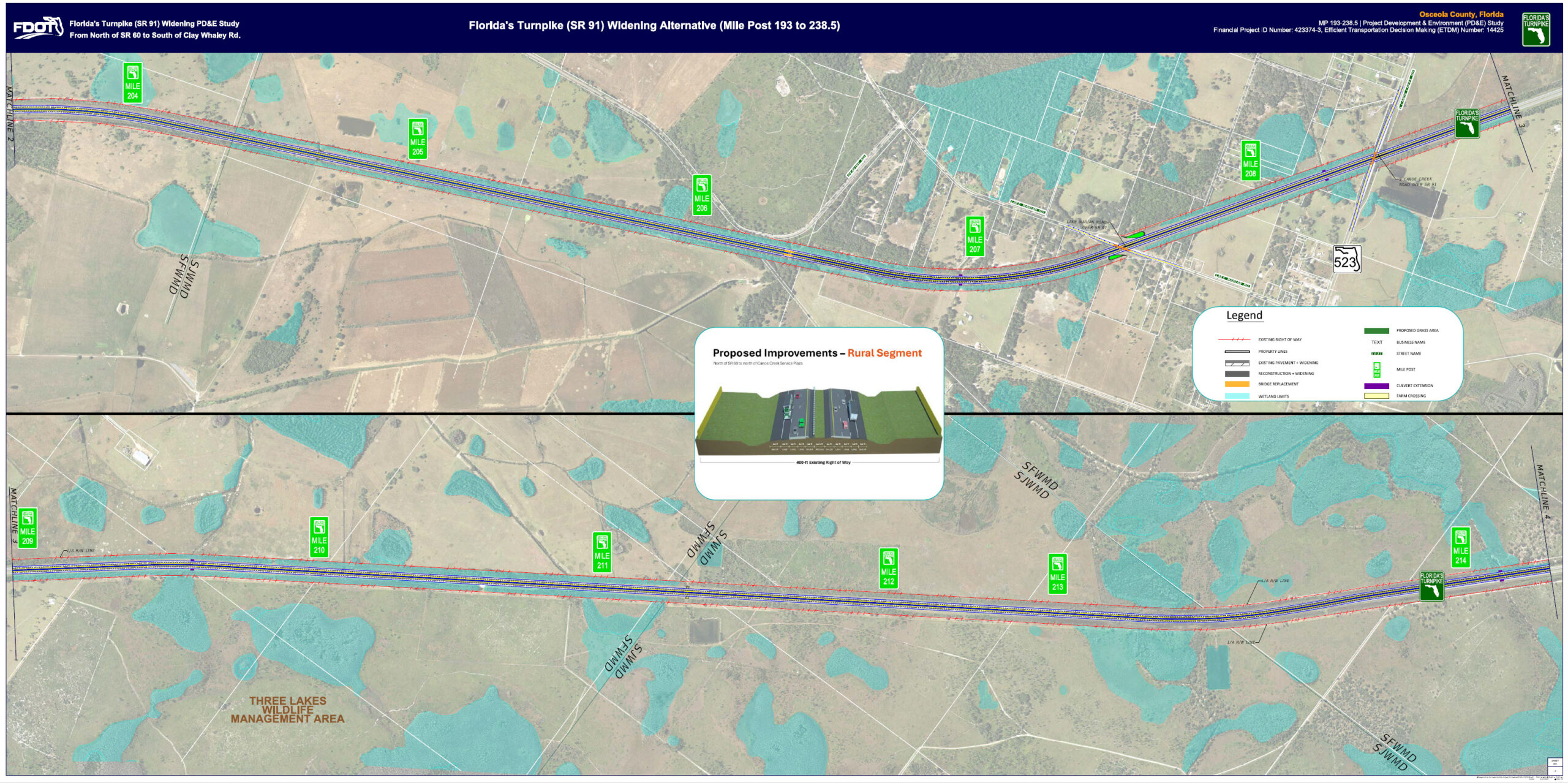
This exhibit presents the proposed improvement for the project segment between mile post 194 (begin study) to 204. The Turnpike widening alternative includes three lanes in each direction to meet future traffic demands. The legend on the exhibit provides a visual explanation of the symbols and lines used.
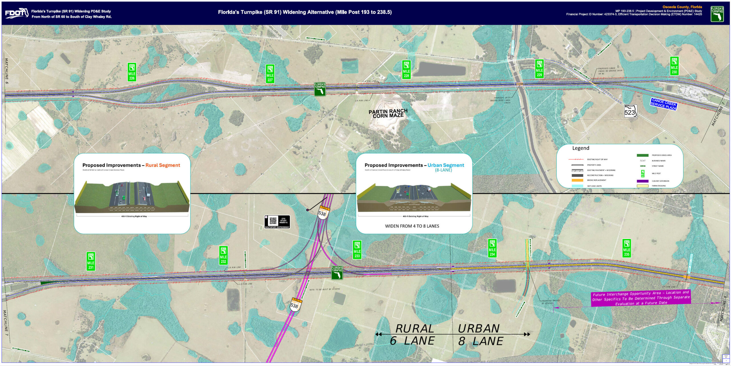
This exhibit presents the proposed improvement for the project segment between mile post 225 to 236. The Turnpike widening alternative includes three lanes in each direction south of mile post 234 and four lanes in each direction north of mile post 234 to meet future traffic demands. The legend on the exhibit provides a visual explanation of the symbols and lines used.
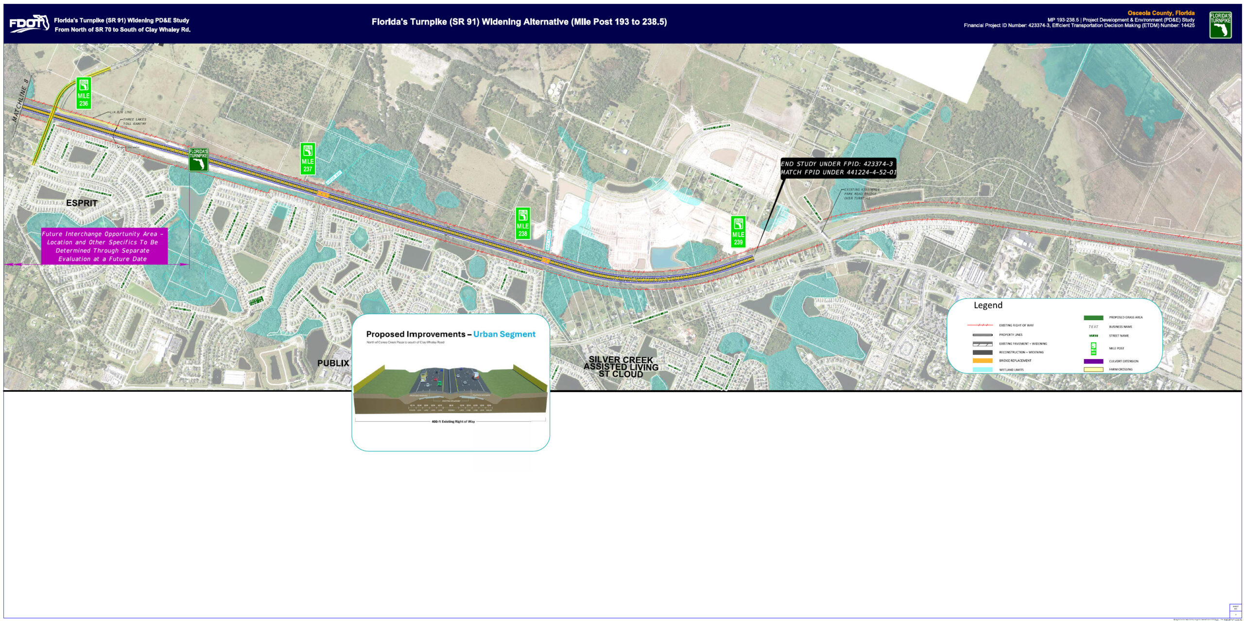
This exhibit presents the proposed improvement for the project segment between mile post 236 to 239 (end study). The Turnpike widening alternative includes four lanes in each direction to meet future traffic demands. The legend on the exhibit provides a visual explanation of the symbols and lines used.
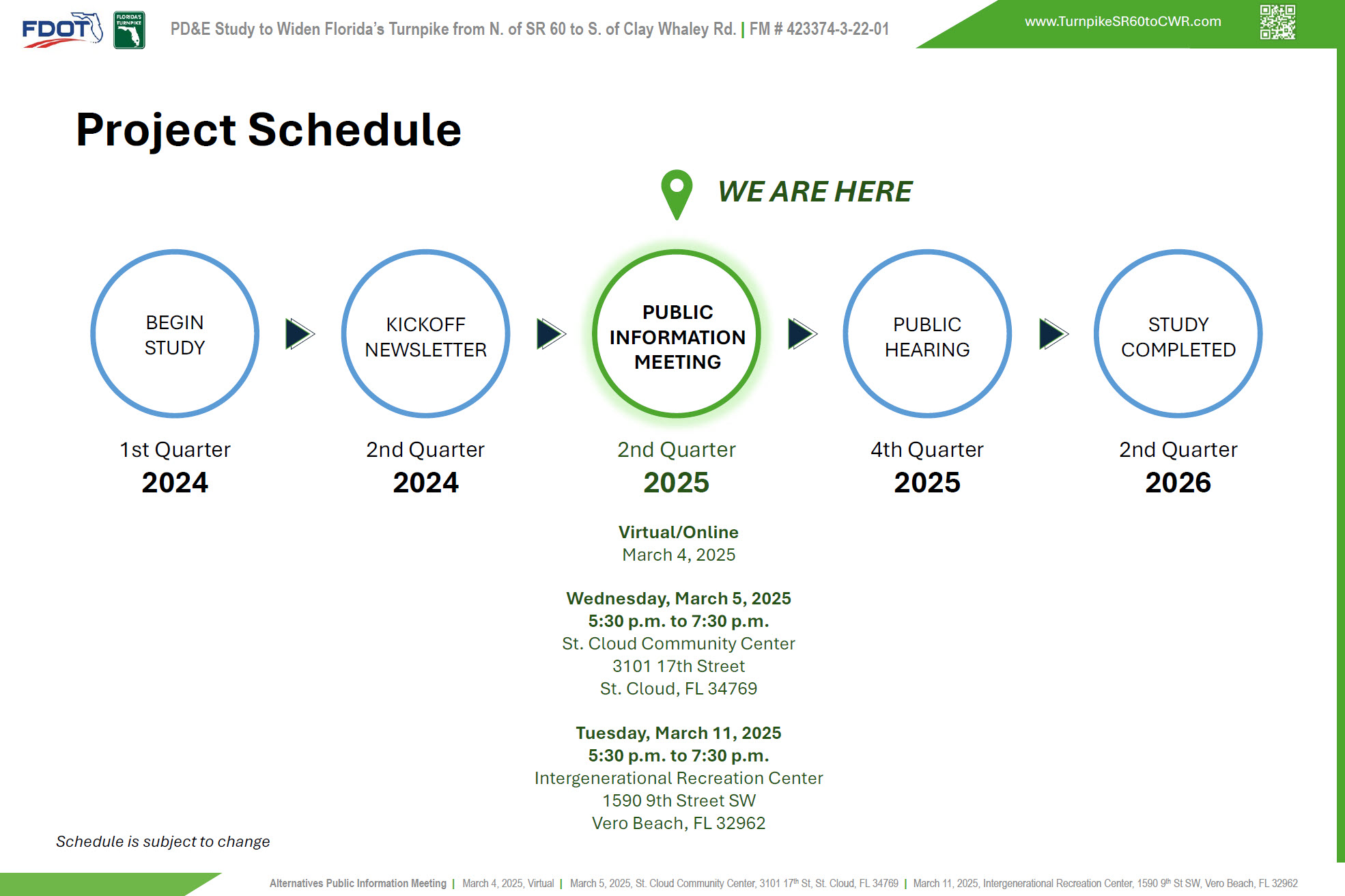
After the alternatives public information meeting, we will consider local agency and public comments and environmental and engineering factors to reach a recommendation of a preferred alternative. We anticipate presenting the preferred alternative for public input at a public hearing in the 4th quarter of 2025 before the study concludes in the 2nd quarter of 2026. Note that the schedule is subject to change.

