WELCOME!
The Florida’s Turnpike Enterprise appreciates your interest in this project. Please use the navigation menu to view public meeting videos and display boards. Clicking on the graphic will enlarge the view. The display boards are available for download on the main project website under the Documents section. If you wish to submit comments, please use the comment form below.
- Welcome
- Title VI
- Project Location
- Project Development Process
- Existing Typical Sections
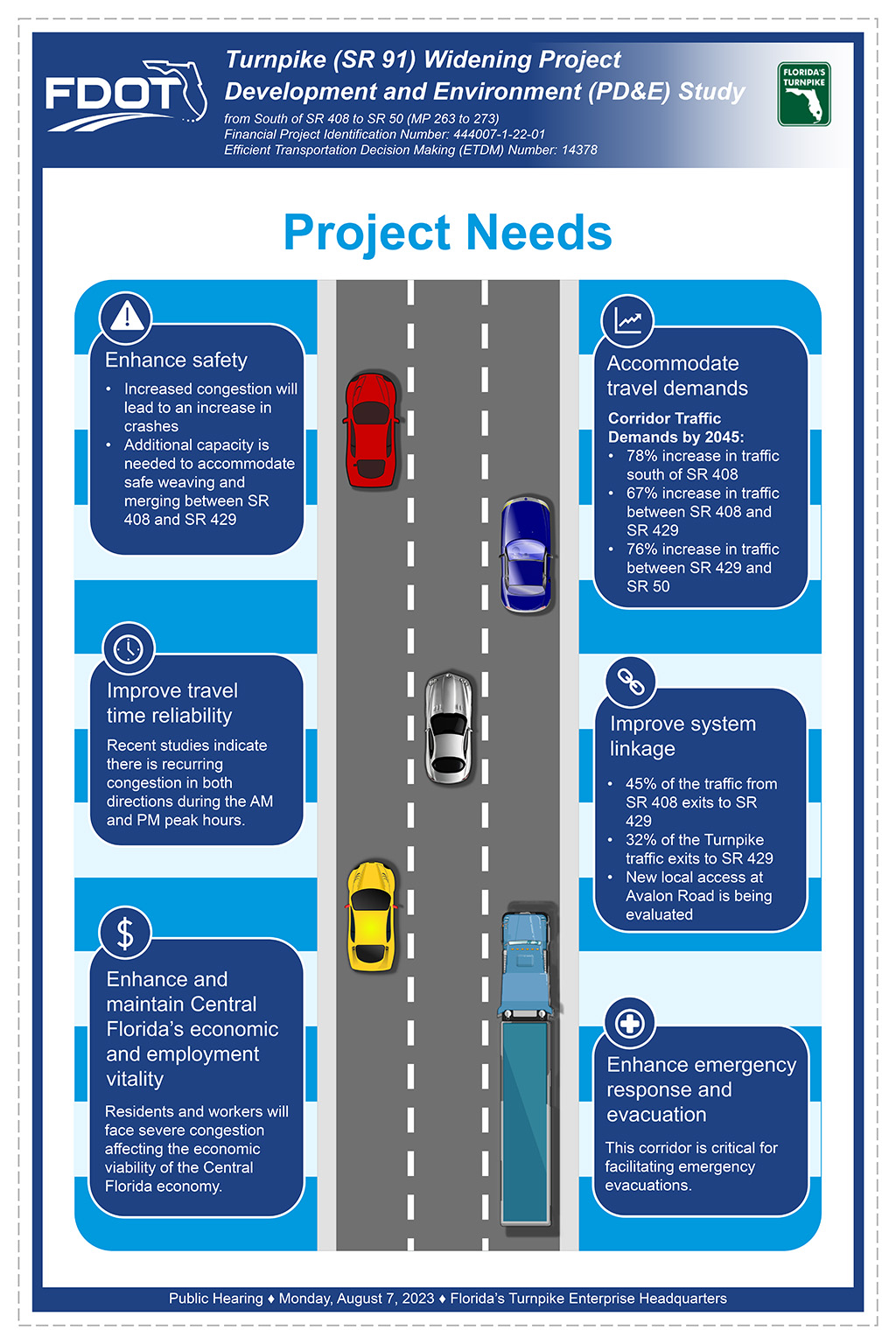
- Project Needs
- 2045 AM Traffic Comparison
- 2045 PM Traffic Comparison
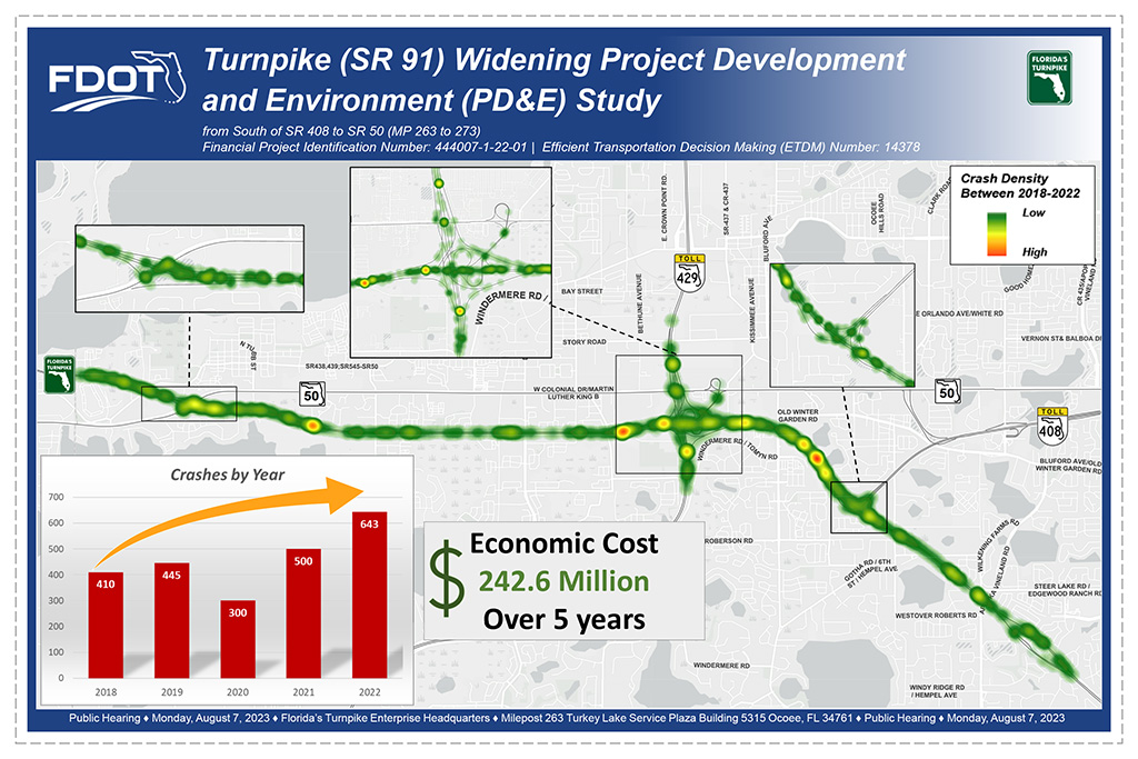
- Existing Crashes
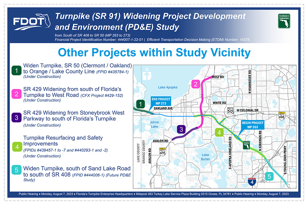
- Other Projects within Study Area
- Proposed Typical Sections
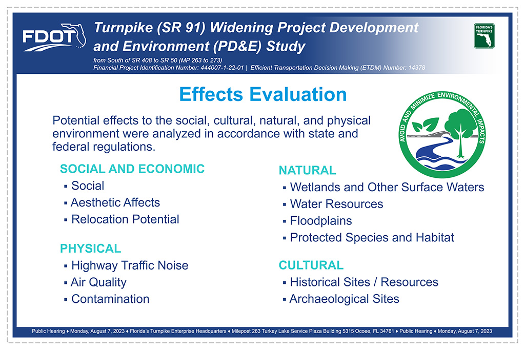
- Effects Evaluation
- Photo Simulations
- SR 408 to SR 429 System
- Preferred Alternative 1 of 4
- Preferred Alternative 2 of 4
- Preferred Alternative 3 of 4
- Preferred Alternative 4 of 4
- Evaluation Matrix
- Right of Way Acquisition
- Schedule
- Contact
- Thank You
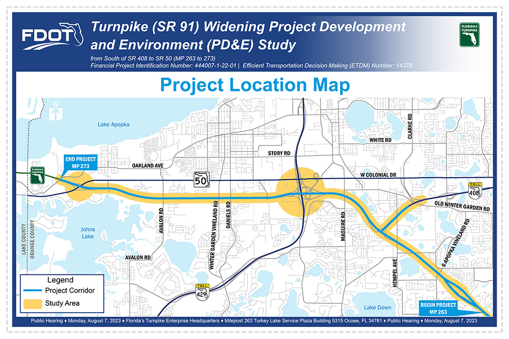
- The Florida Department of Transportation, Florida’s Turnpike Enterprise, welcomes you to the Public Hearing for the Project Development and Environment (PD&E) Study to Widen Florida’s Turnpike from south of SR 408 to SR 50 in Orange County.
- Please use the navigation below menu to view public hearing materials. Clicking on the graphic will enlarge the view. The display boards are available for download on the main project website under the Documents section.
- To provide a comment at any point during your visit, simply click on the “View Comment Form” button shown below. Complete your comment and click “Submit.” We look forward to receiving your input and continuing to work with you throughout the study.
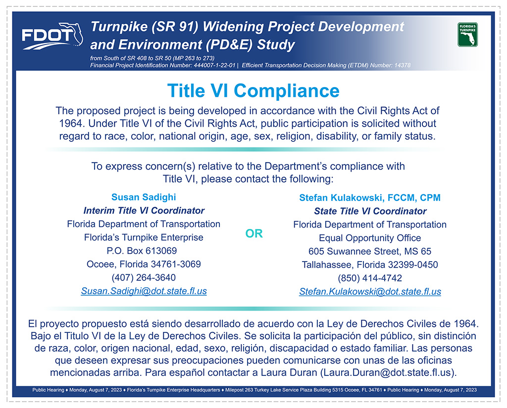
- This project is being developed in accordance with the Civil Rights Act of 1964. Under Title VI of the Civil Rights Act, public participation is solicited without regard to race, color, national origin, age, sex, religion, disability, or family status. Please contact one of the Title VI coordinators shown here to express any concerns regarding Florida Turnpike’s compliance with Title VI.
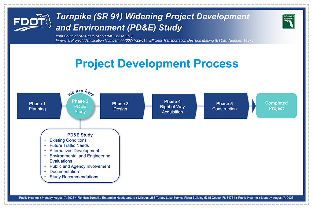
- A PD&E Study determines if there is an engineering and environmentally feasible alternative to meet the future needs determined in the planning phase. This involves the preparation of preliminary engineering and environmental documentation.
- Key components of the PD&E process include an evaluation of existing conditions, identification of future traffic needs, development of alternatives, and an evaluation of the alternatives based on environmental and engineering factors. Key components of the PD&E process include coordination with local public agencies and collection of input from local citizens, which occur throughout study. All findings and recommendations are documented at the end of the study. If a Preferred Alternative is selected, the project then moves into the design phase. For more information on the PD&E Study process visit the project website, scroll down to the Documents section, and under the Videos drop-down menu you will find a video which details the PD&E process.
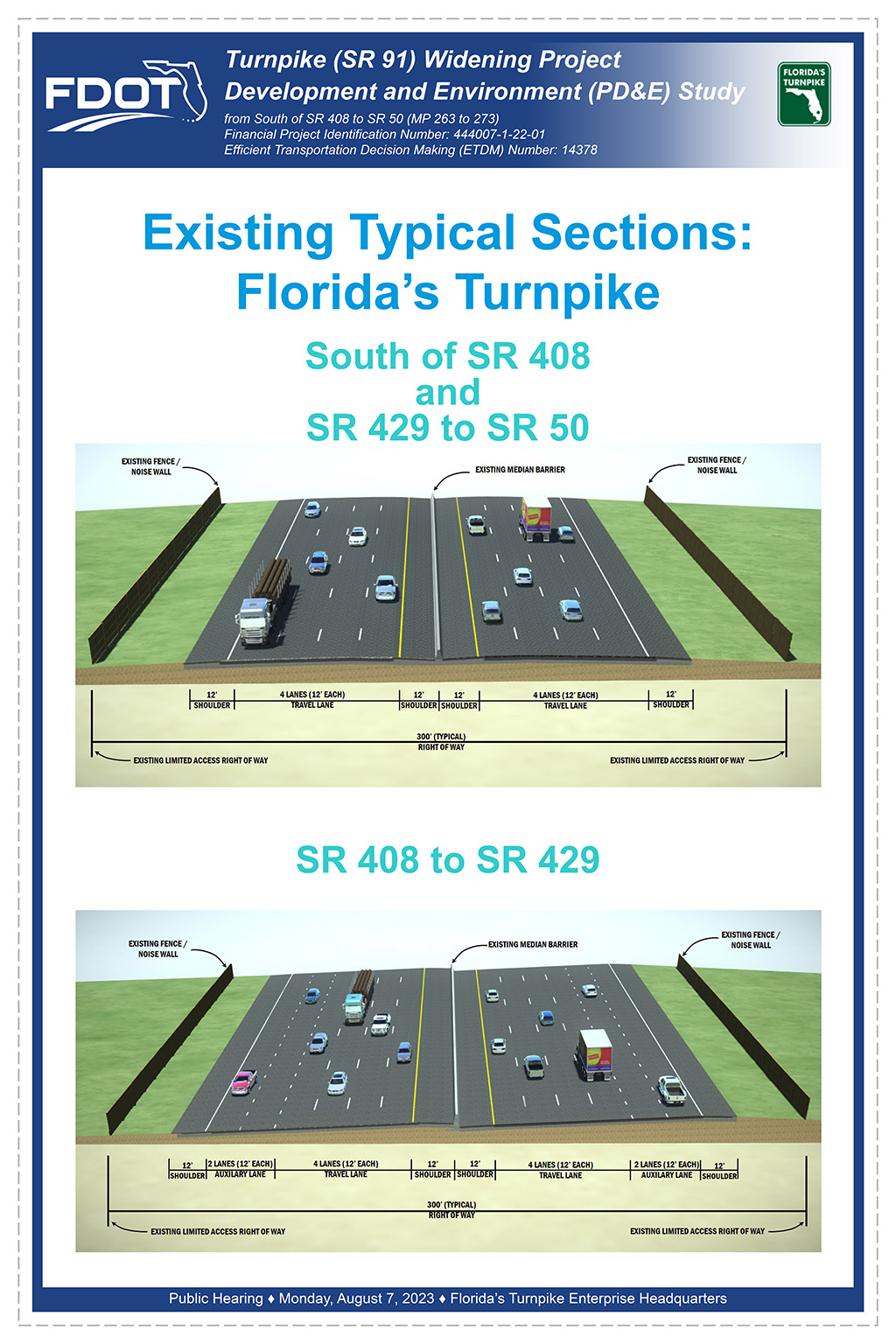
- Currently, the portion of Florida’s Turnpike, south of the Turkey Lake Service Plaza to SR 408 and from SR 429 to SR 50 feature eight travel lanes (four lanes in each direction), while the portion between SR 408 and SR 429 contains eight travel lanes (four lanes in each direction) along with two auxiliary lanes in each direction.
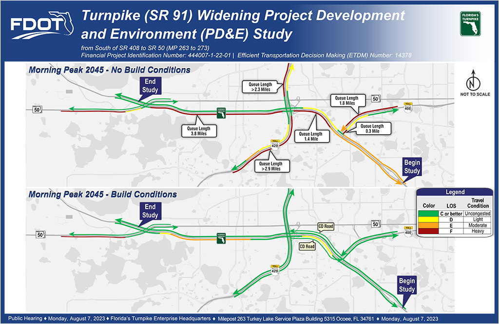
- In the morning peak hour, “No-Build” condition, several portions of Florida’s Turnpike and SR 429 are in Level of Service (LOS) F, indicating heavy traffic with backups.
- In the “Build” condition, the proposed improvements will improve LOS on the system, reduce backups and system queues along Florida’s Turnpike, SR 429, and SR 408
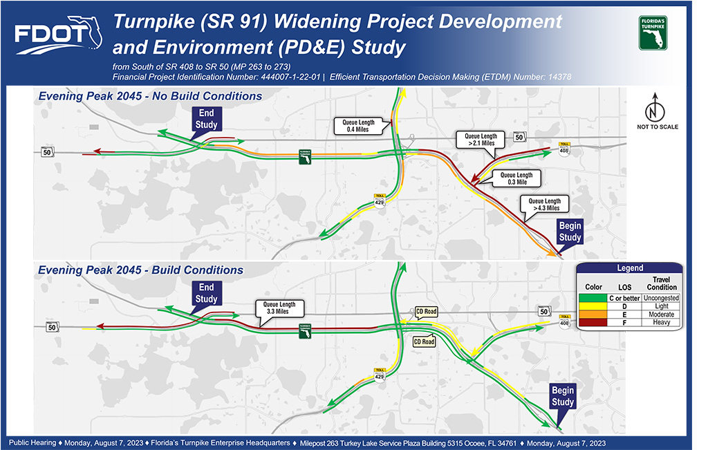
- In the evening peak hour, “No-Build” condition, several areas of severe congestion can be seen, particularly in the vicinity of the Florida’s Turnpike/SR 408 interchange.
- In the “Build” condition, the proposed improvements will improve conditions by reducing the number of long queue length locations, particularly in the vicinity of the Florida’s Turnpike SR 408 interchange.
- To accommodate regional growth, there are several PD&E, design, and construction projects near this PD&E Study. The most important projects relative to this study include the widening of Florida’s Turnpike between SR 50 interchange (Clermont / Oakland) to the Orange/Lake County, widening of SR 429 from south of Florida’s Turnpike to West Road, widening of SR 429 from Stoneybrook West to south of Florida’s Turnpike, resurfacing and safety improvements from milepost 260 to 273, and a potential future widening of the Turnpike from south of Sand Lake Road to south of SR 408. These projects alone do not accommodate the anticipated traffic increases associated with growth in this region and additional improvements are still needed.
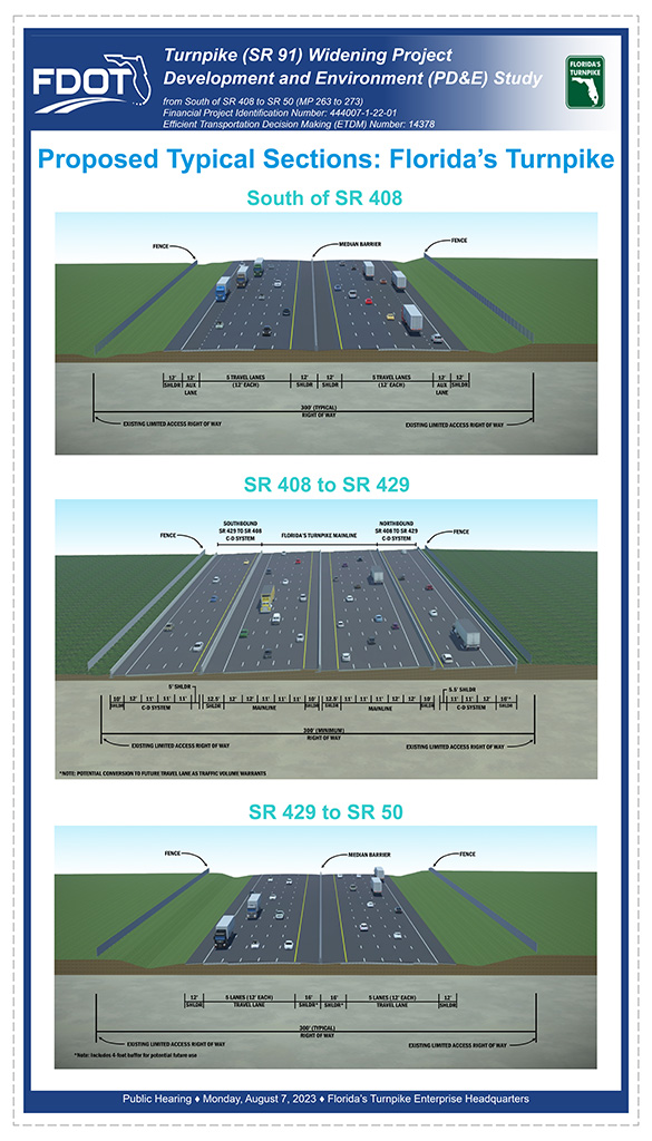
- South of SR 408 – The proposed improvements widen Florida’s Turnpike by adding two new lanes in each direction. The new lanes will be constructed on the outside of the existing lanes.
- SR 408 to SR 429 – The collector-distributor (CD) system separates the longer distance, regional trips from the shorter local trips traveling between the SR 408 and SR 429 interchanges. The proposed system will construct five travel lanes in each direction to serve the longer distance regional trips. To the outside, the southbound CD system will have three 11-foot travel lanes and one 12-foot outside travel lane. The northbound CD system will have two 11-foot travel lanes and one 12-foot outside travel lane. The northbound CD system will feature a 16-foot shoulder which could be potentially converted to a future travel lane or part time shoulder use as traffic volume warrants. The CD system will provide direct connections between SR 408 and SR 429. Concrete barriers are proposed between the systems to eliminate conflicts and improve the overall safety features of the segment. Together, these systems will provide the capacity needed to meet the projected travel demand and separate the movements to reduce the crash potential. This CD concept will improve traffic operation, reduce congestion, and improve the overall safety of the corridor.
- SR 429 to SR 50 – The proposed improvements widen Florida’s Turnpike in this segment by adding one new lane in each direction. The new lanes will be constructed on the outside of the existing lanes.
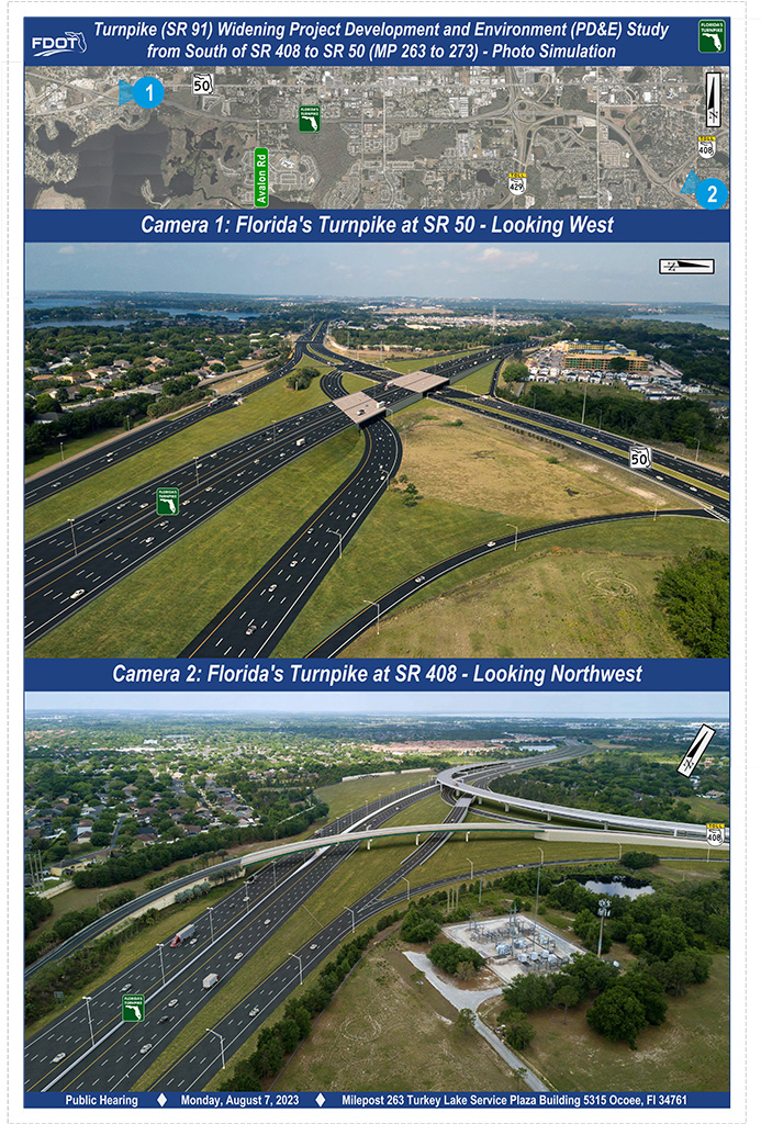
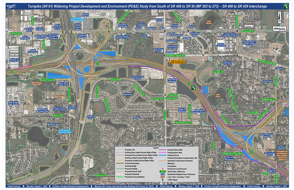
- This exhibit depicts the proposed improvements to the Turnpike mainline segment between SR 408 and SR 429, including modifications at both the SR 408 and SR 429 interchanges. The Turnpike mainline would be expanded to include dedicated lanes that provide direct connections between the SR 408 and SR 429 interchanges. The exhibit includes the improvements for the SR 50 (Ocoee / Winter Garden) interchange which features an upgraded bridge to meet current design criteria, as well as an upgraded loop ramp. The bicycle and pedestrian facilities will be replaced or enhanced to ensure the safety for non-motorized travelers.
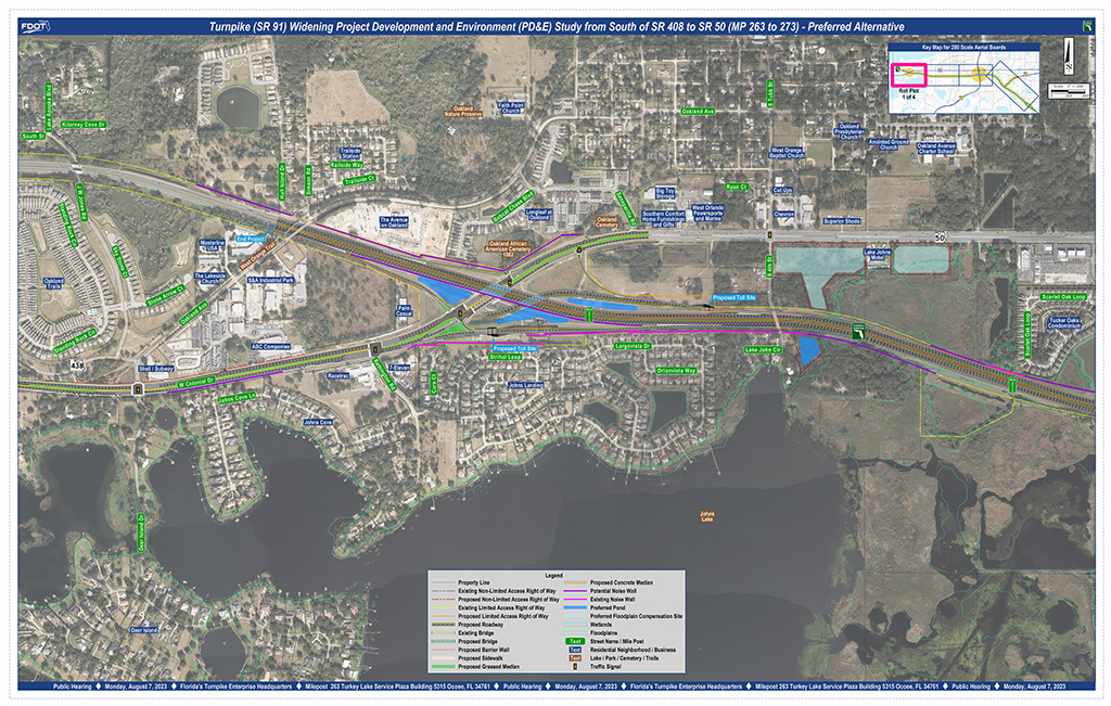
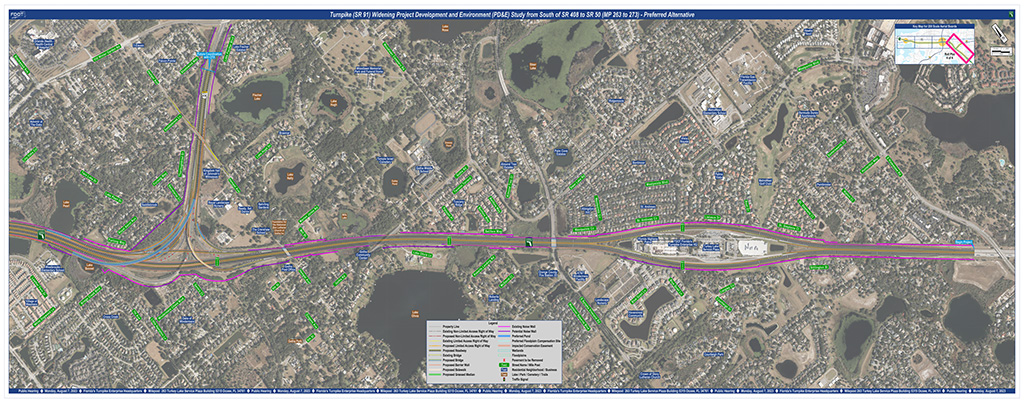
- This exhibit presents the proposed improvement for the northern project segment between mile post 271 to 273. The Turnpike mainline includes five lanes in each direction to meet future traffic demands. The SR 50 interchange improvement features a modified diverging diamond. This solution provides a new four-lane northbound exit ramp that will serve the high evening traffic volumes headed towards Clermont / Oakland and Lake County. SR 50 will also be enhanced with the addition of a westbound auxiliary lane between the interchange and Oakland Avenue. A new 12-foot-wide shared use path will also be constructed along SR 50 to enhance the pedestrian and bicycle features. The legend on the exhibit provides a visual explanation of the symbols and lines used.
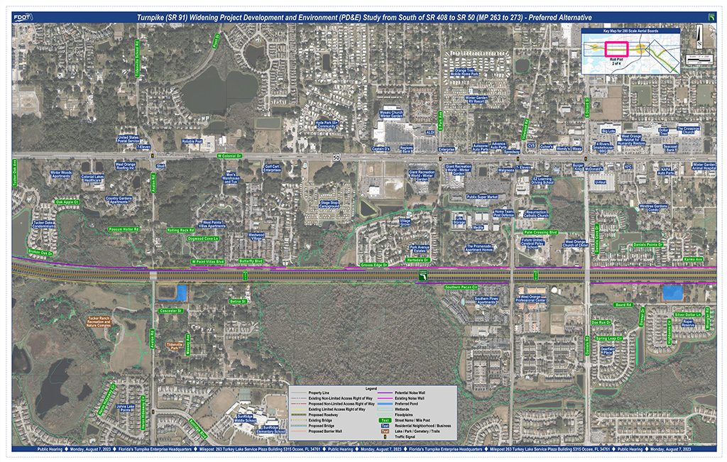
- This exhibit presents the proposed improvement for the third project segment between mile post 266 to 268. The Turnpike mainline includes five lanes in each direction to meet the future traffic demands north of the SR 429 interchange. A collector-distributor road system is shown between SR 429 and SR 408 that will provide direct connections between these two major interchanges. Please refer to the “SR 408 to SR 429 System” graphic for a more detailed view of the proposed improvements between SR 408 and SR 429. The legend on the exhibit provides a visual explanation of the symbols and lines used.
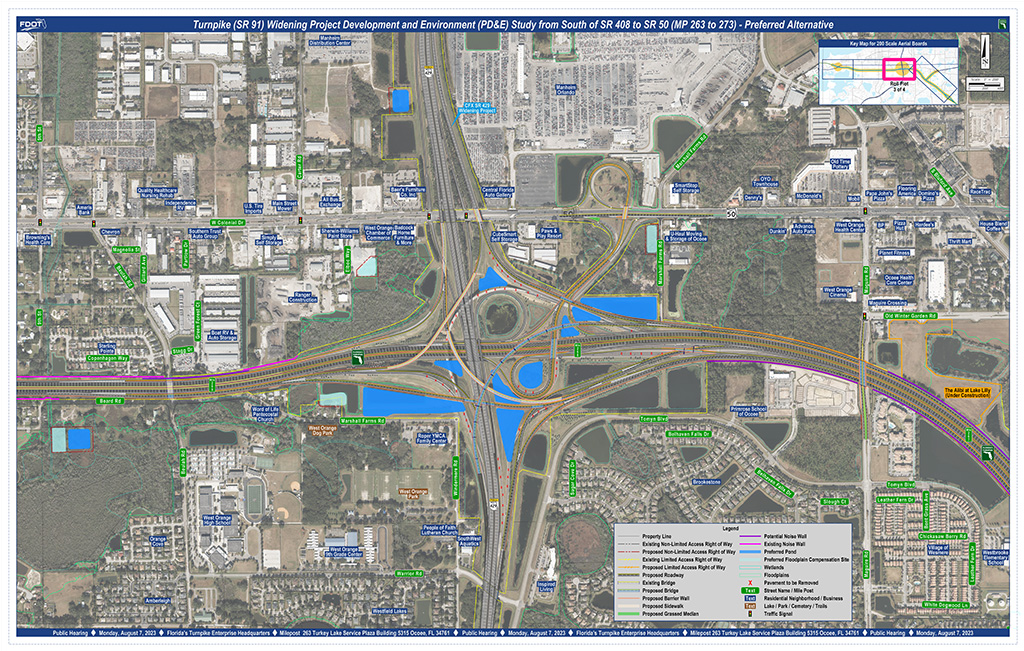
- This exhibit presents the proposed improvement for the southern project segment between mile post 263 to 267. The Turnpike mainline includes five lanes in each direction south of the SR 408 interchange to meet future traffic demands. A collector-distributor road system is shown between SR 429 and SR 408 that will provide direct connections between these two major interchanges. Please refer to the “SR 408 to SR 429 System” graphic for a more detailed view of the proposed improvements between SR 408 and SR 429. The legend on the exhibit provides a visual explanation of the symbols and lines used.
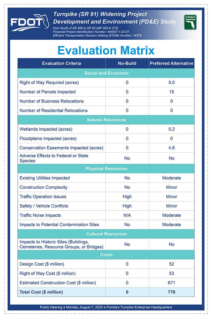
- The evaluation matrix summarizes the effects evaluation results of the Preferred Alternative in comparison to the No-Build Alternative. The Preferred Alternative improves future traffic operations and safety but requires right of way, wetland, surface water, floodplain, and conservation easement impacts. The total project cost, including design, right of way, and construction is approximately $776 million dollars.
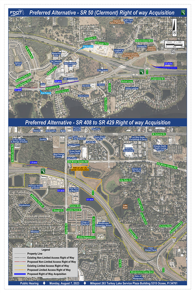
- Approximately 4.1 acres of additional right of way will be required to construct the proposed interchange improvements at State Road 50, exit 272.
- Approximately 1.2 acres of additional right of way will be required to construct the proposed improvements between SR 408 and SR 429. Additional right of way will also be required to accommodate the proposed new ponds. The locations and quantities will be refined during the final design phase.
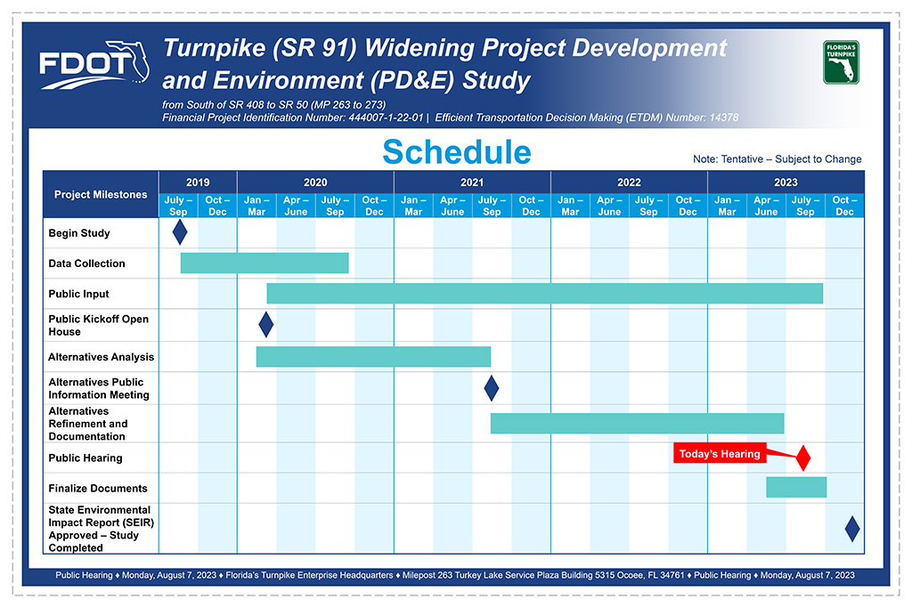
- Following the Alternatives Public Information Meeting, public comments were reviewed in conjunction with social, cultural, environmental, and engineering factors to reach a recommendation on a Preferred Alternative. The Preferred Alternative is shown at this Public Hearing. This study is expected to be completed in the fourth quarter of 2023. Please note that this schedule is subject to change.

