The Florida Department of Transportation, Florida’s Turnpike Enterprise, welcomes you to the Public Hearing for the Project Development and Environment (PD&E) Study for the widening of Florida’s Turnpike Mainline from north of S.R. 60 to south of Clay Whaley Road, in Osceola County.
- Welcome
- Title VI
- PD&E Process
- About the Study
- Adjacent Studies
- Traffic Needs
- Environmental
- Alternatives Matrix
- Florida’s Turnpike Widening Alternative Concept 1 of 5
- Florida’s Turnpike Widening Alternative Concept 2 of 5
- Florida’s Turnpike Widening Alternative Concept 3 of 5
- Florida’s Turnpike Widening Alternative Concept 4 of 5
- Florida’s Turnpike Widening Alternative Concept 5 of 5
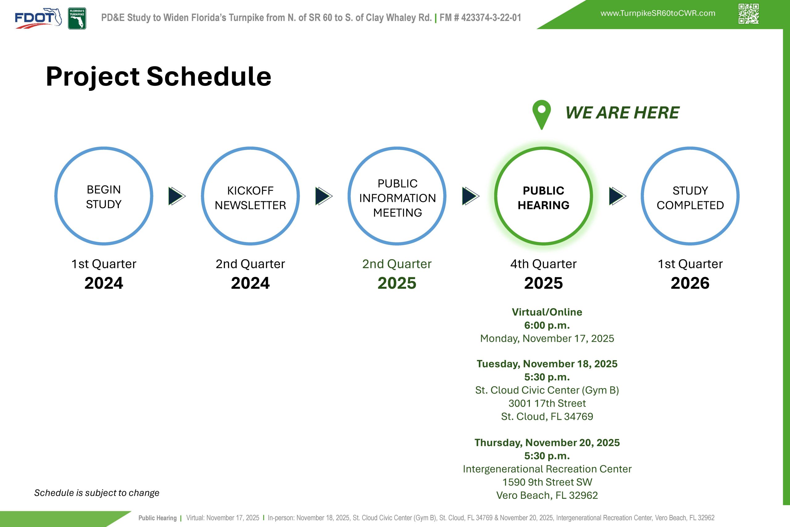
- Project Schedule
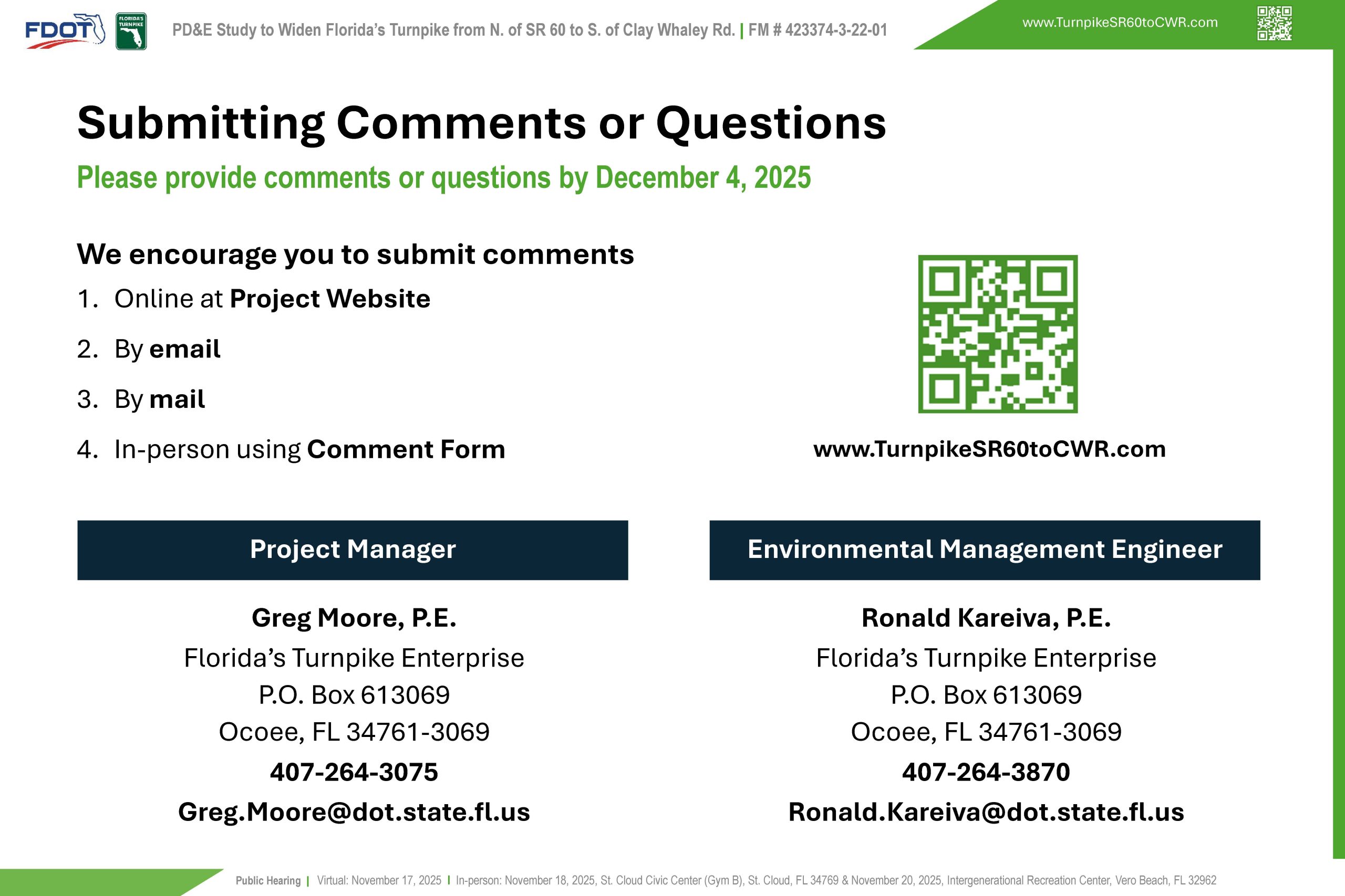
- Contact Information
The Enterprise complies with various non-discrimination laws and regulations, including Title VI of the Civil Rights Act of 1964. Under Title VI of the Civil Rights Act, public participation is solicited without regard to race, color, national origin, age, sex, religion, disability, or family status. Please contact one of the Title VI coordinators shown here to express any concerns regarding Florida Turnpike’s compliance with Title VI.
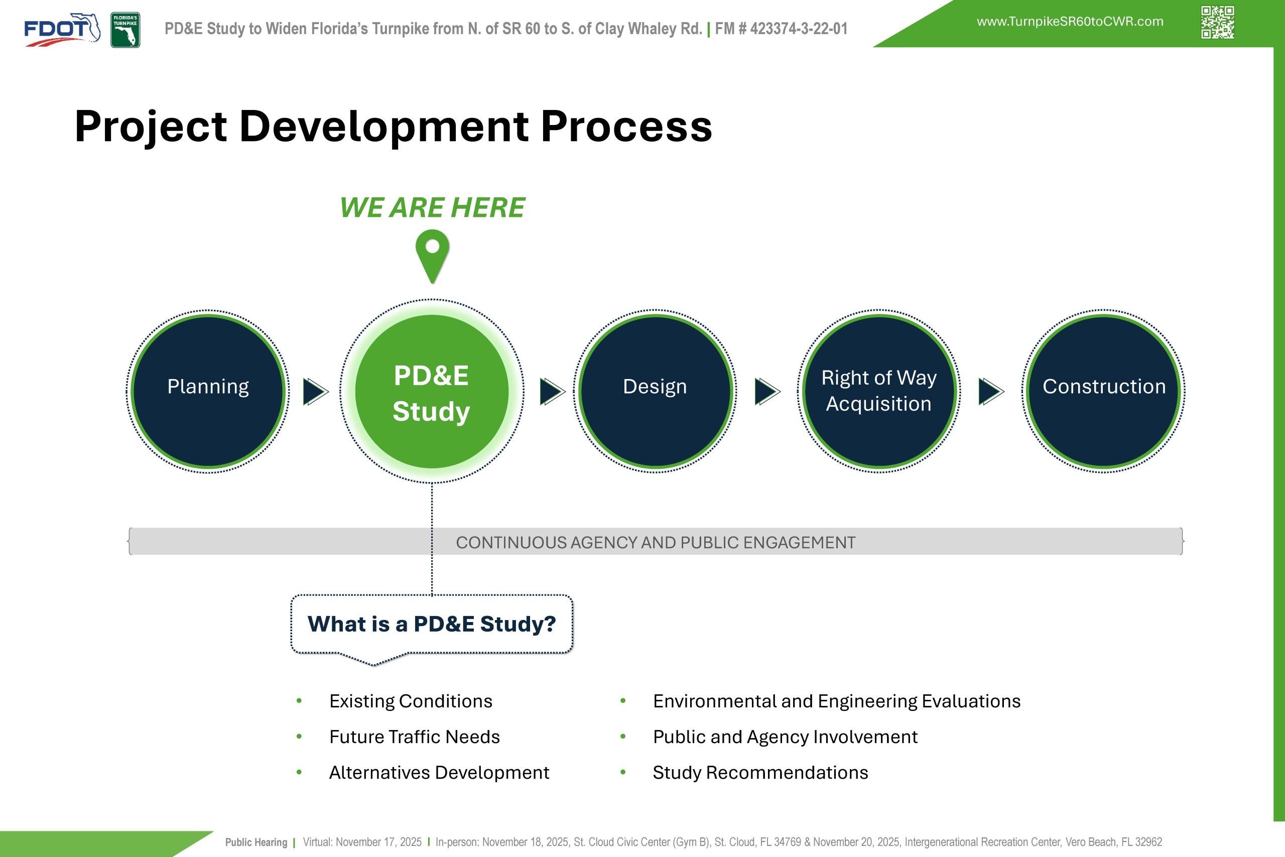
A PD&E Study is the second phase of FDOT’s Transportation Project Development process. Key components of the PD&E Study include an evaluation of existing conditions, identification of future traffic needs, development and evaluation of project alternatives, and public and agency involvement.
All findings and recommendations are documented at the end of the study. Subsequent phases include final design and engineering, right of way acquisition, when needed, and construction. Right of way acquisition is not anticipated for this project. The subsequent phases are currently not funded but will be considered for funding upon the completion of the PD&E Study.
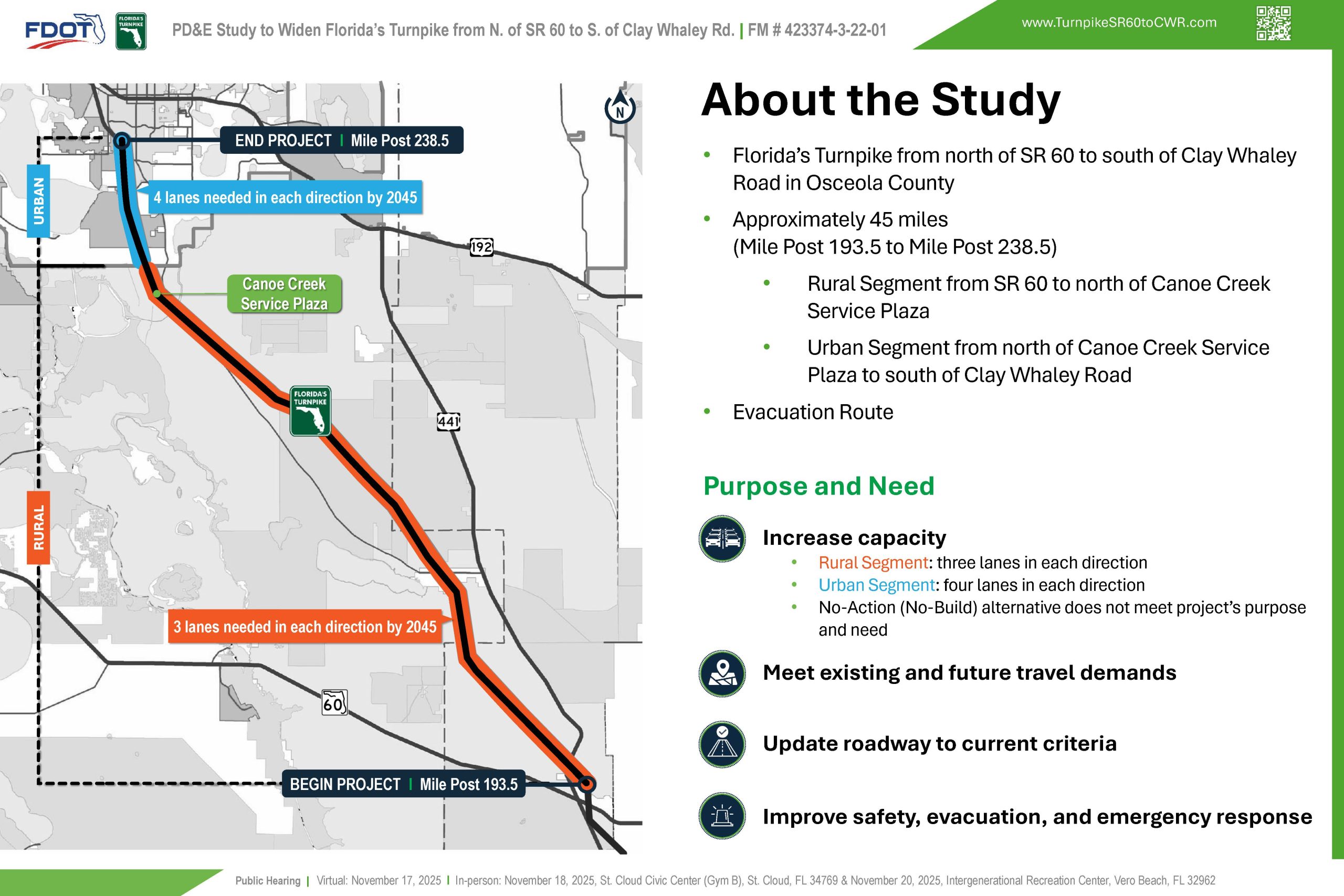
This PD&E Study is located in Osceola County. The project begins north of S.R. 60 and continues to south of Clay Whaley Road, from milepost 193.5 to 238.5, a distance of approximately 45 miles.
The segment from S.R. 60 to just north of the Canoe Creek Service Plaza is primarily rural, transitioning to an urban setting toward the project’s endpoint.
This section of the mainline features the Canoe Creek Service Plaza, passes through the Three Lakes Wildlife Management Area, and serves as a critical evacuation route for Florida.
The purpose and need is to increase capacity, meet existing and future travel demands, update the roadway to current criteria, and improve safety, evacuation, and emergency response.
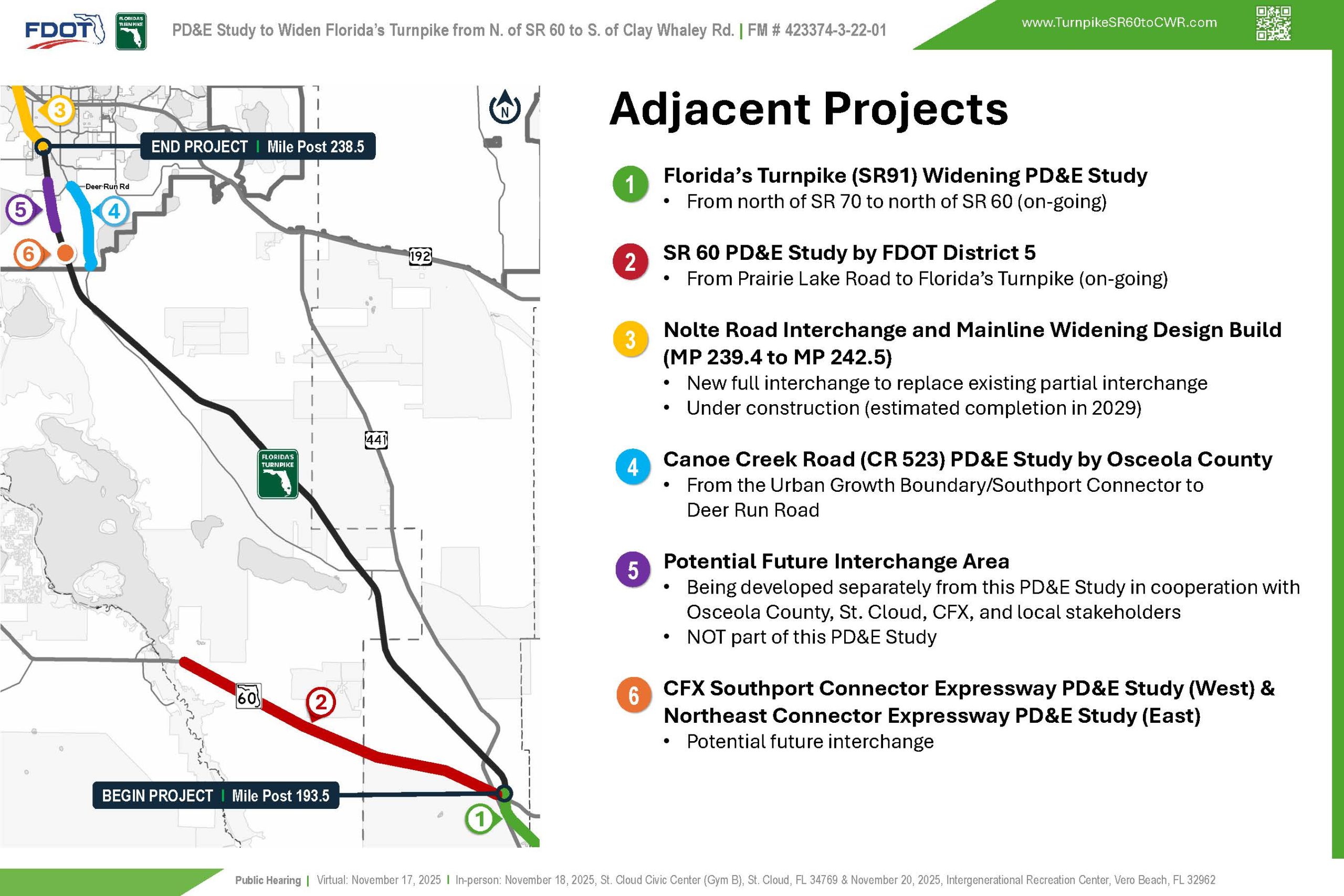
This PD&E Study is part of a larger network of improvement projects spanning both north and south of the project limits. Ongoing coordination with adjacent projects has been maintained and will continue throughout the duration of the study.
This includes collaboration with the on-going Turnpike’s PD&E study to the south from north of State Road 70 to north of State Road 60, coordination with the on-going FDOT District 5 PD&E study along State Road 60 from Prairie Lake Road to the Florida’s Turnpike.
Collaboration is also taking place with projects to the north including coordination with the Nolte Road Interchange and Mainline Widening Design Build team, the Osceola County Canoe Creek Road PD&E Study from the Urban Growth Boundary to Deer Run Road and a separate concept study that will analyze and document the potential location of a future interchange between south of Clay Whaley Road and Osceola County’s planned extension of Waterlin Boulevard over the Turnpike Mainline.
Additionally, multiple coordination efforts have taken place with the Central Florida Expressway Authority regarding the potential future interchange for the Southport and Northeast Connector PD&E Studies.
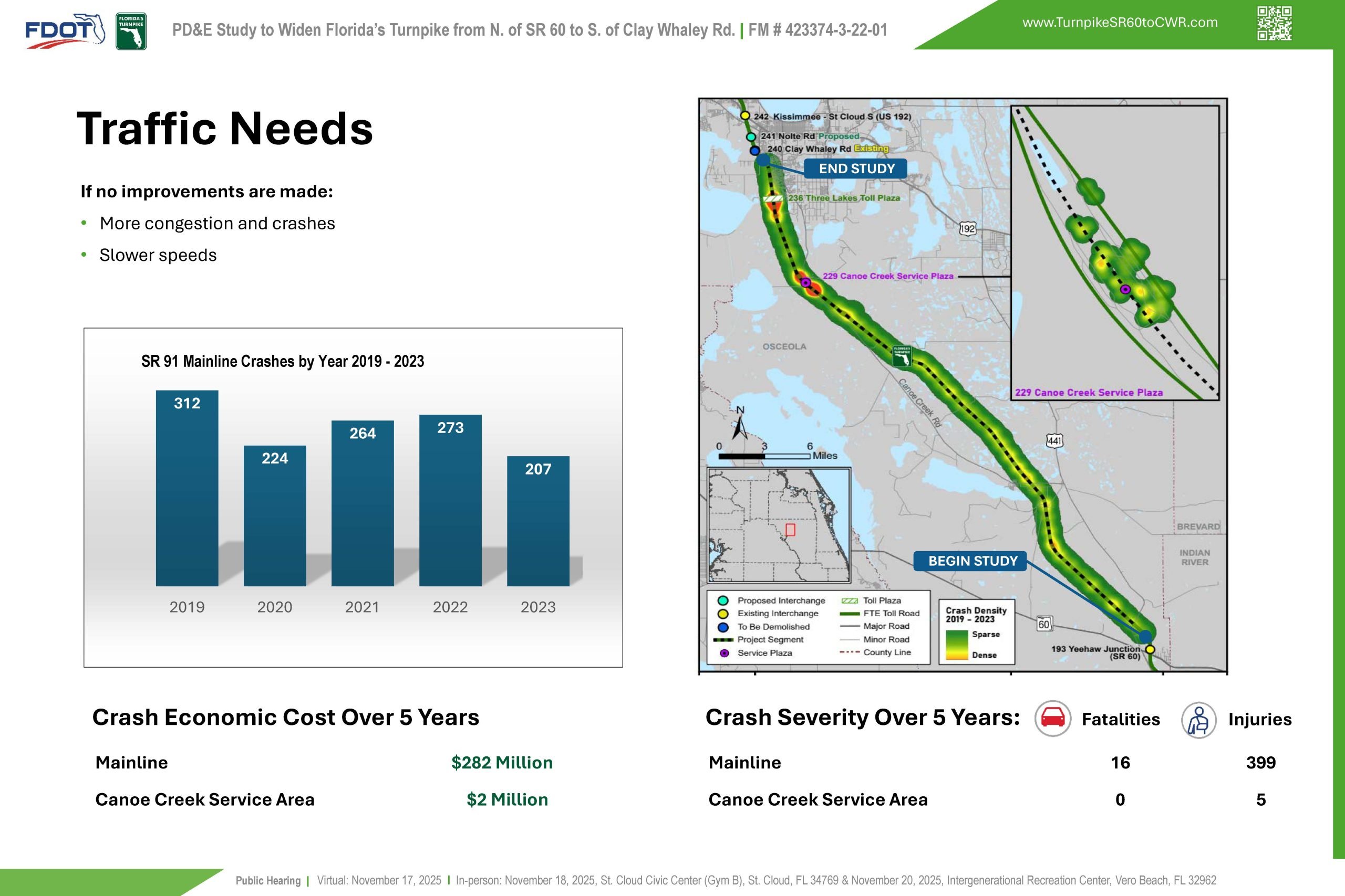
If no improvements are made, an increase in the travel demand could result in more congestion and crashes. Between the years 2019 to 2023, there were 1,280 crashes along the Florida’s Turnpike Mainline which resulted in 16 fatalities and 399 injuries within the study limits. A total of 45 crashes were also reported within the vicinity of the Canoe Creek Service Area. The total crashes estimated economic cost within the study limit was about 284 million dollars between the years 2019 to 2023
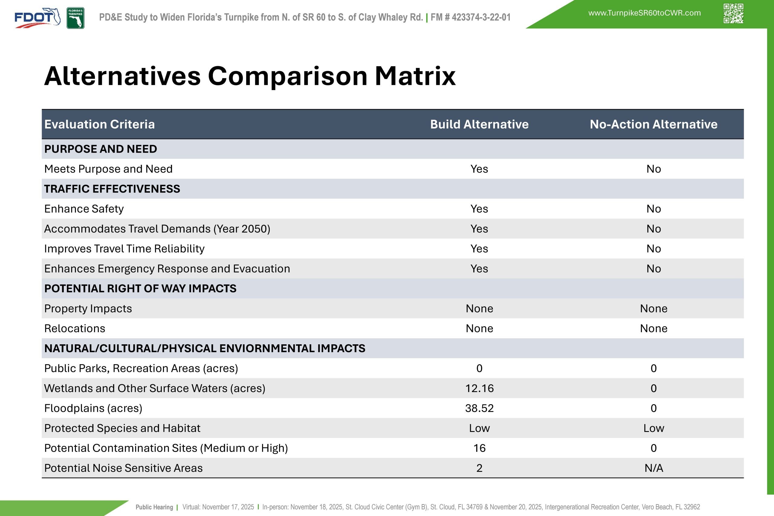
This alternatives comparison matrix compares the Preferred build Alternative to the No-Action Alternative. The preferred build alternative addresses the purpose and need of the study and does not have right of way impacts.
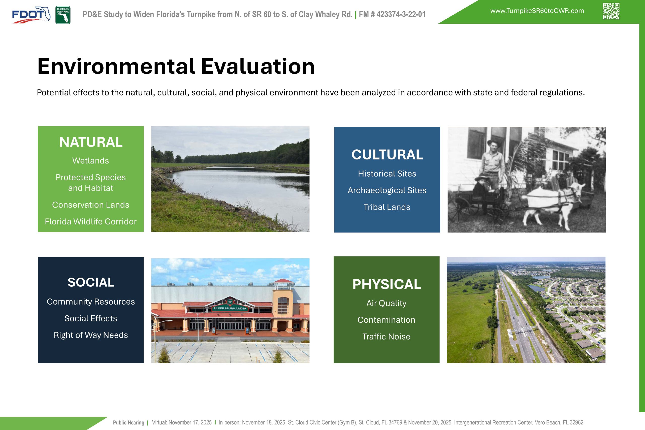
Regarding the natural, cultural and physical environmental effects, the preferred build alternative has impacts to wetlands and other surface waters, low impacts to protected species and habitat, impacts to potential contamination sites, and impacts to two potential noise sensitive areas.
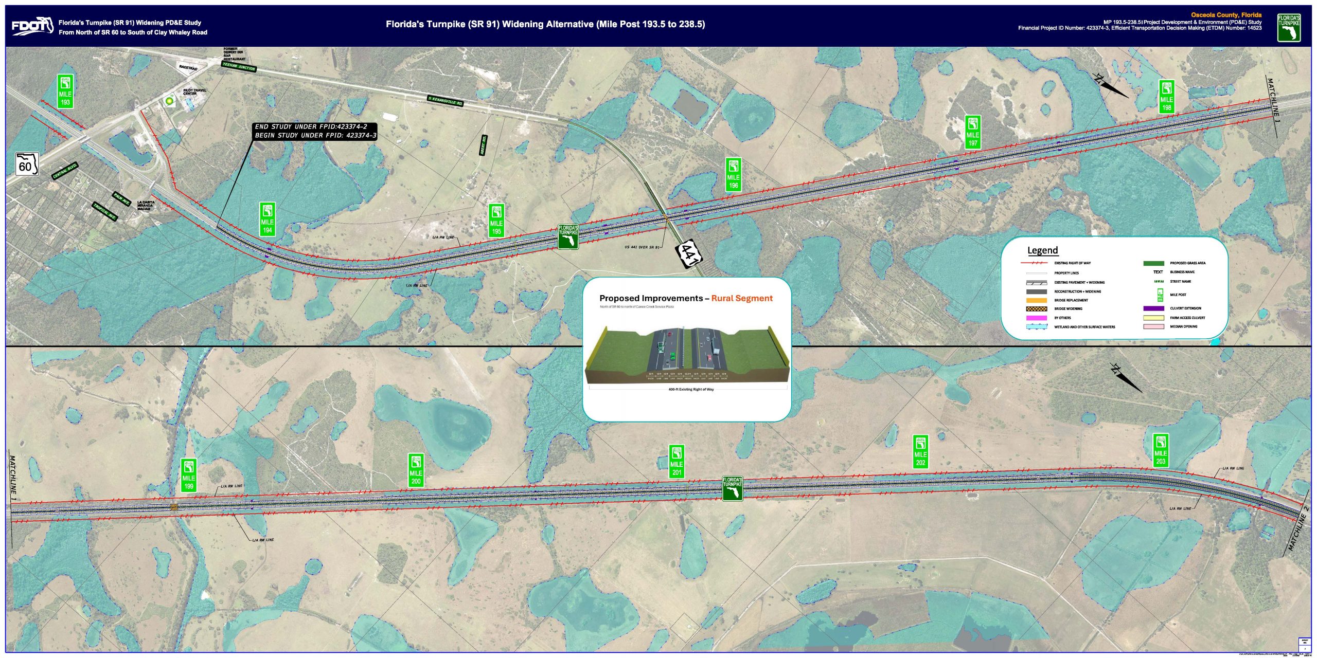
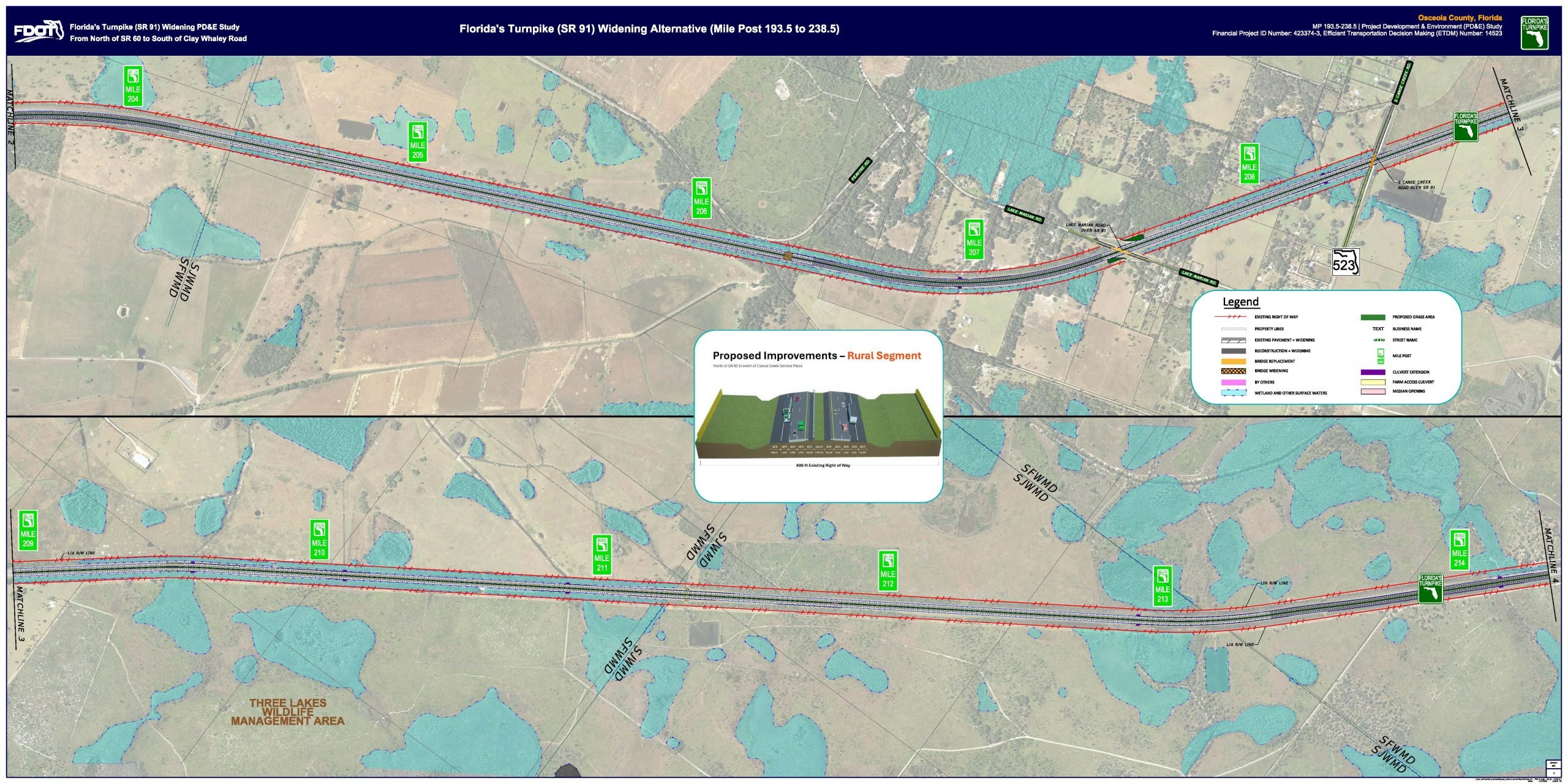
This exhibit presents the proposed improvement for the rural segment between mile post 193.5 (begin study) to 203.5. The Turnpike widening alternative includes three lanes in each direction to meet future traffic demands. The legend on the exhibit provides a visual explanation of the symbols and lines used.
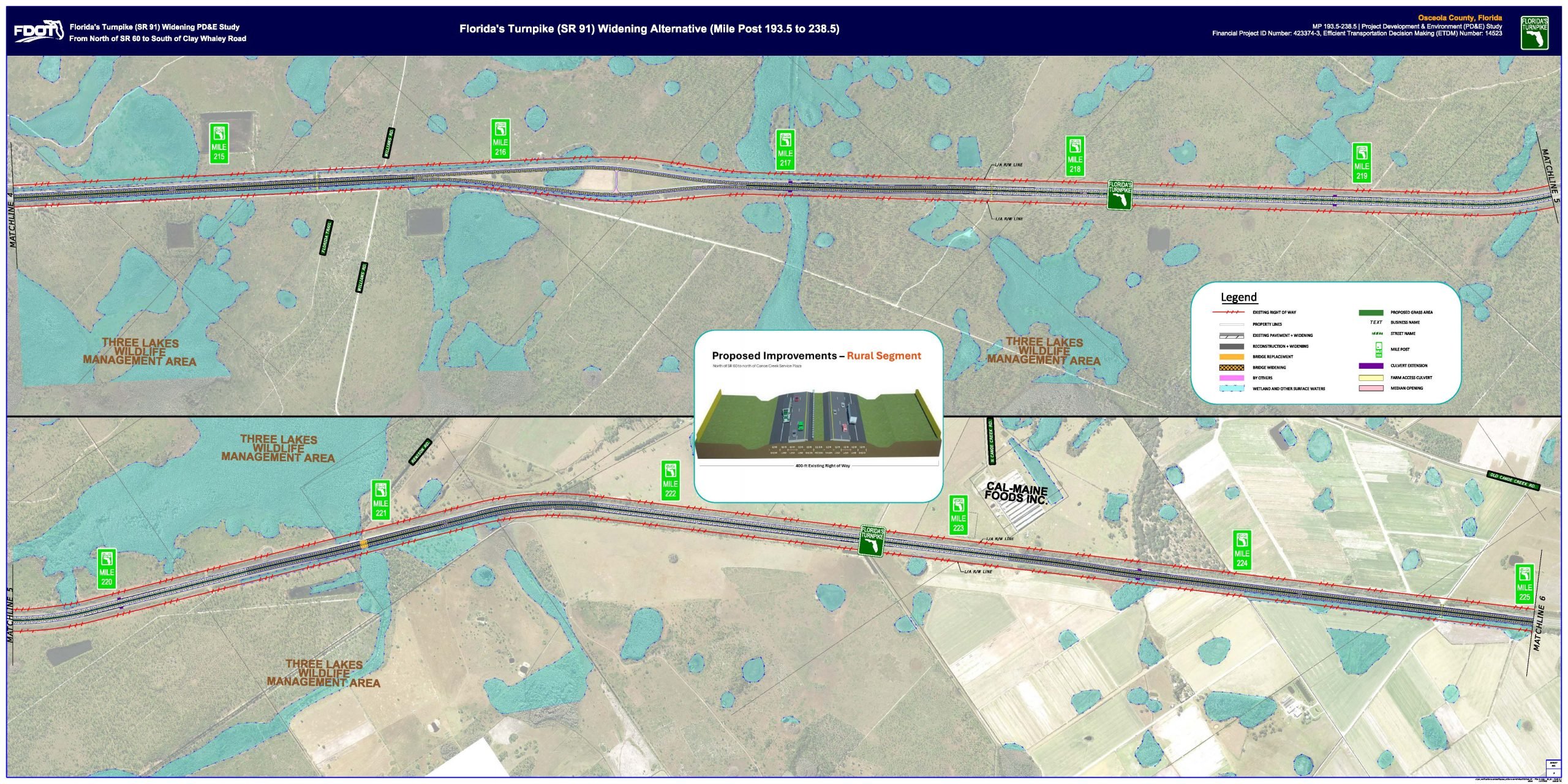
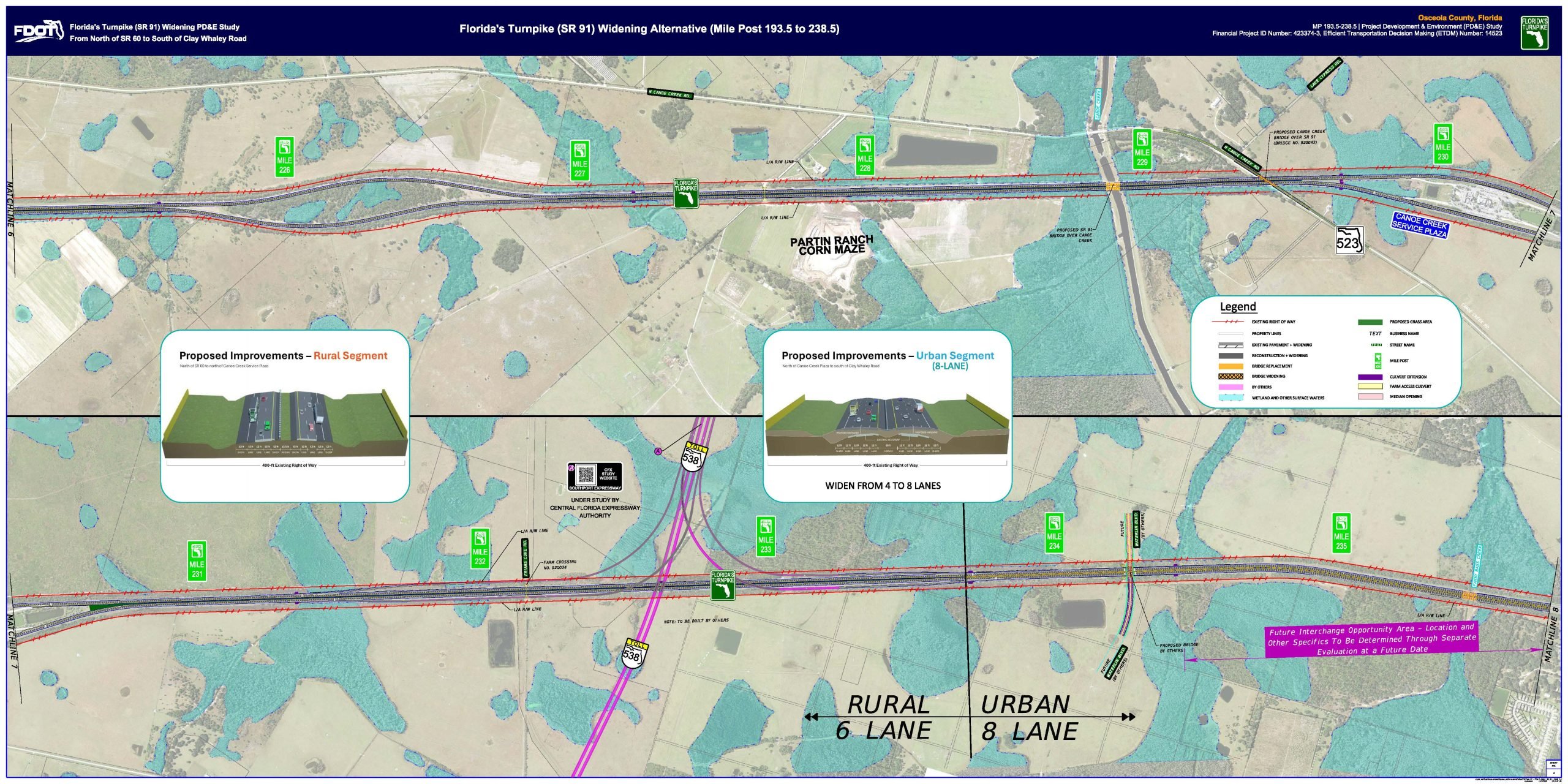
This exhibit presents the proposed improvement for the rural and urban segment between mile post 225 to 236. The Turnpike widening alternative includes three lanes in each direction in the rural segment and four lanes in each direction in the urban segment to meet future traffic demands. The legend on the exhibit provides a visual explanation of the symbols and lines used.
This exhibit presents the proposed improvement for the urban segment between mile post 236 to 238.5 (project end). The Turnpike widening alternative includes four lanes in each direction to meet future traffic demands. The legend on the exhibit provides a visual explanation of the symbols and lines used.
After the Public Hearing, the next step is to incorporate your input into our decision-making process. After the comment period closes and your input has been considered, a decision will be made, and the Final PD&E document will be approved.
This project has and will continue to comply with all applicable state and federal rules and regulations. The PD&E Study is expected to be completed by the 1st quarter of 2026.
Note that the schedule is subject to change
If you would like to make a comment regarding the study, please use one of the methods described here.

