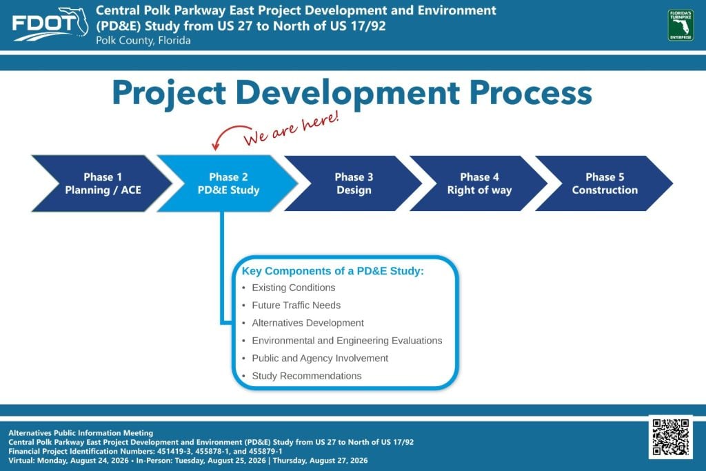
A PD&E Study is the second phase of FDOT’s Project Development Process. It determines the environmental effects associated with a proposed transportation project. Key components of a PD&E Study include an evaluation of existing conditions, identification of future traffic needs, alternatives development, and evaluation of the alternatives based on environmental and engineering factors. An important component of the PD&E process is public and agency involvement. If a Build Alternative is selected, then the project moves forward into the design phase when funds become available.
Virtual Public Meeting Video
Project Development Process
Location Map
Project Purpose and Need
Existing Traffic Conditions
Forecasted Traffic Conditions – No Build
Conceptual Plans
Mainline US 27 to N of Lake Mabel Loop Rd
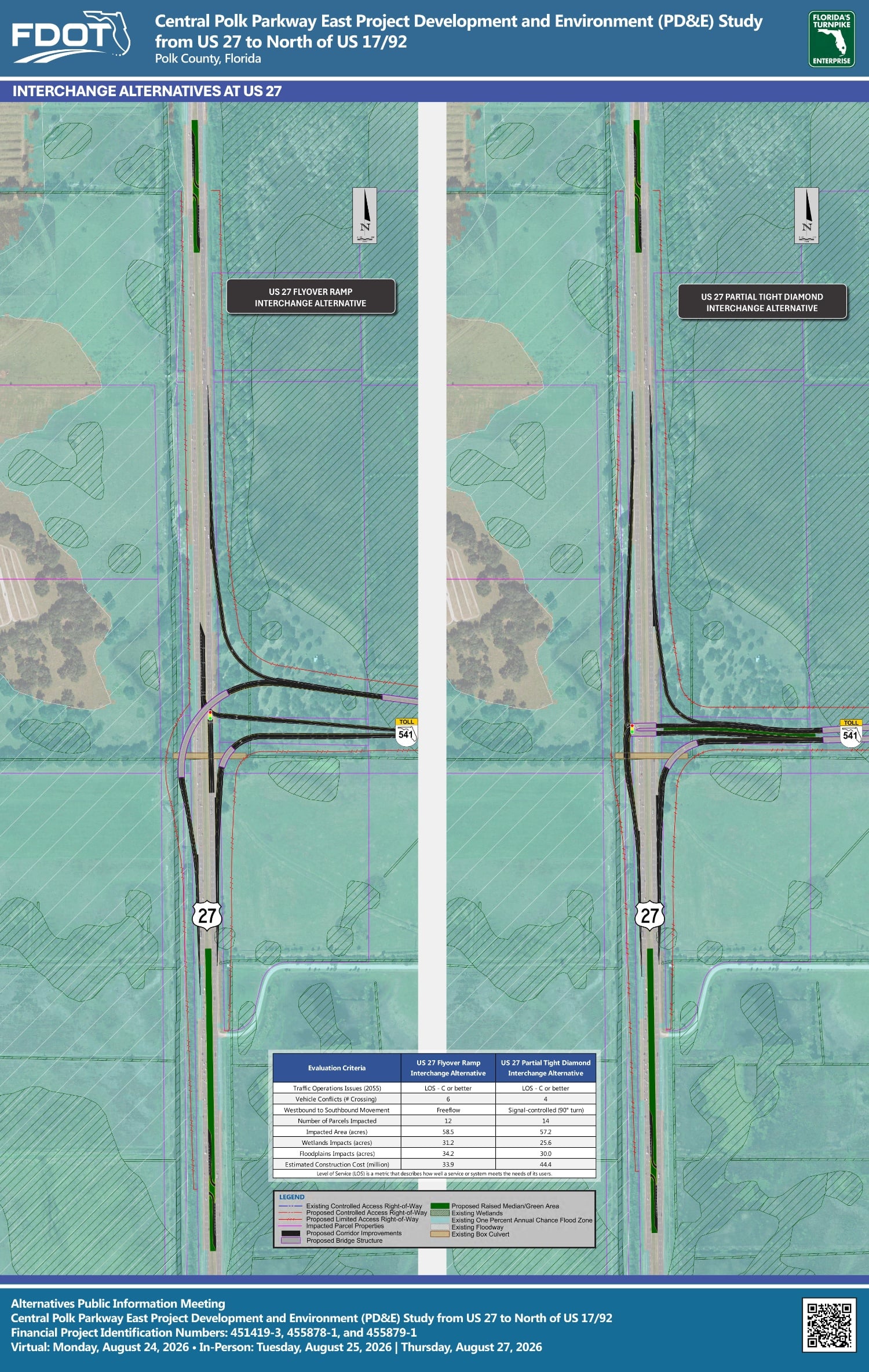
US 27 Interchange
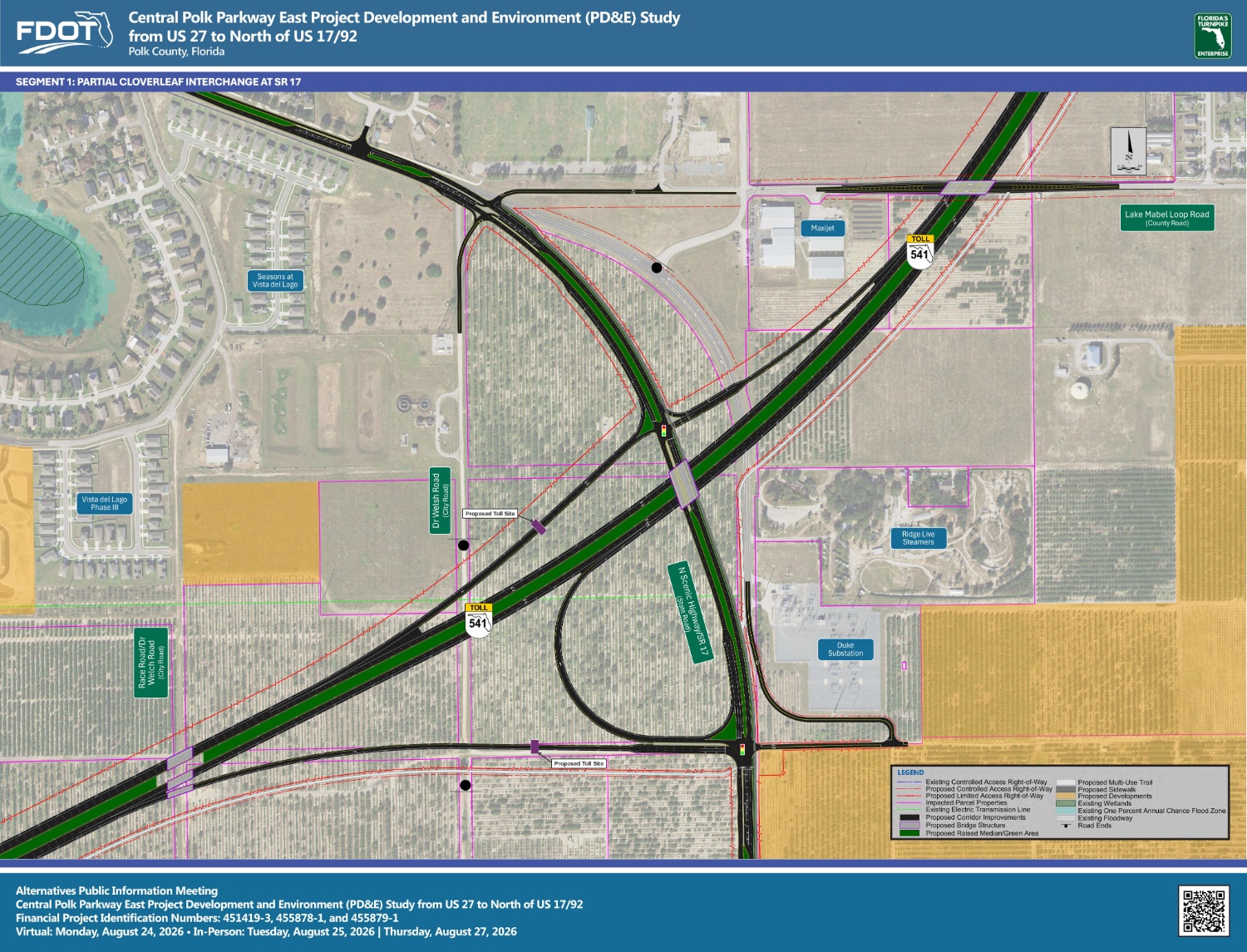
SR 17 Interchange
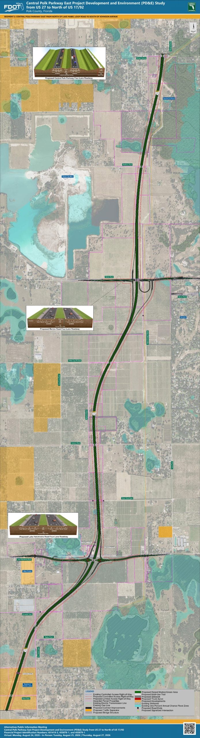
Mainline N of Lake Mabel Loop Rd to S of Johnson Ave
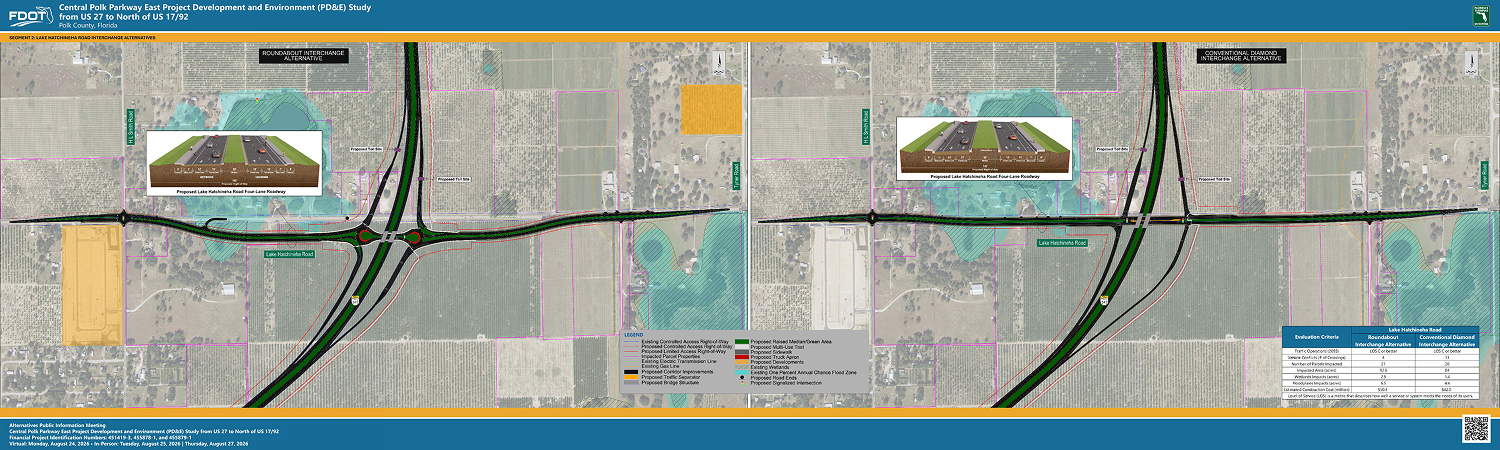
Lake Hatchinhea Rd Interchange
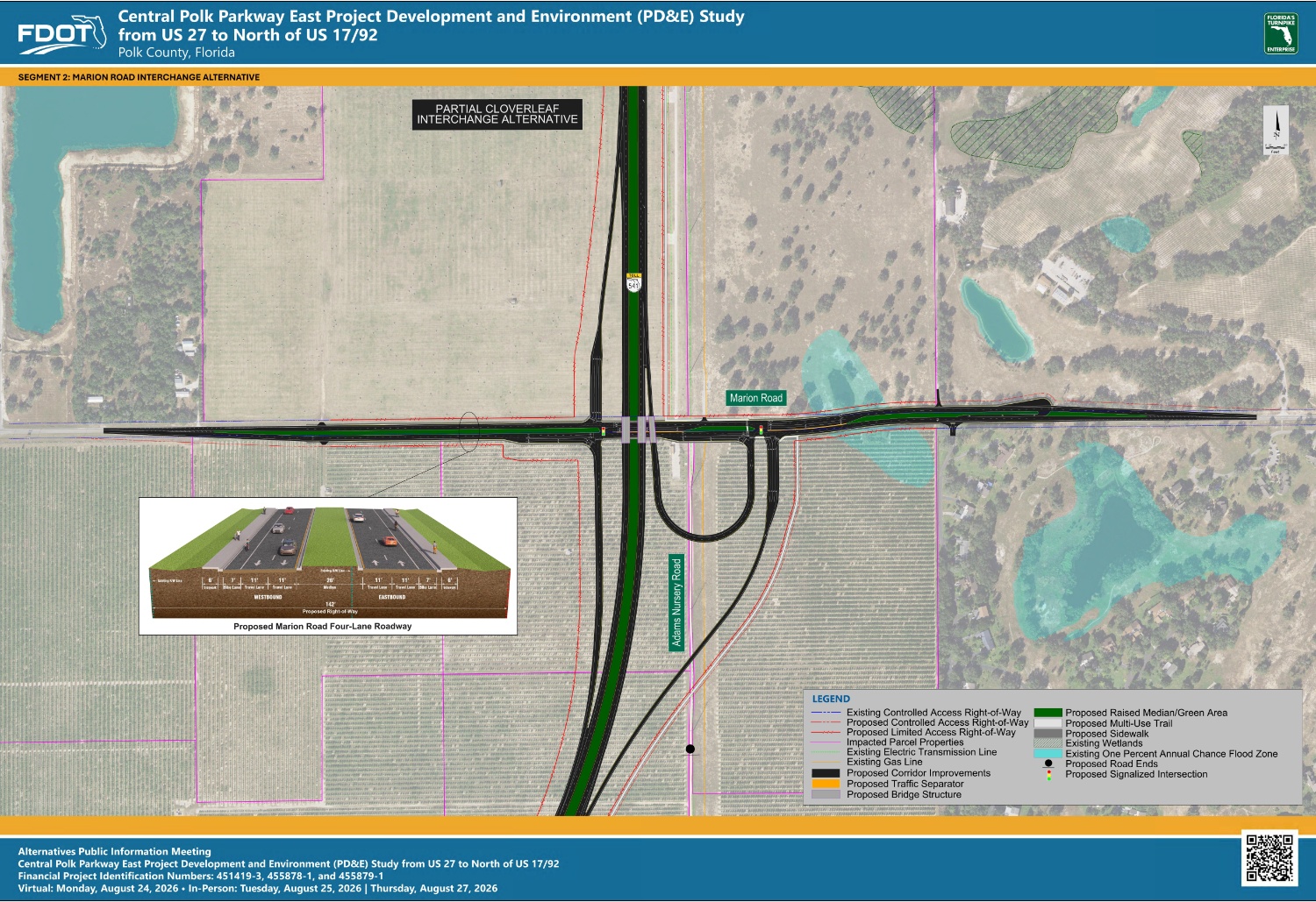
Marion Rd Interchange
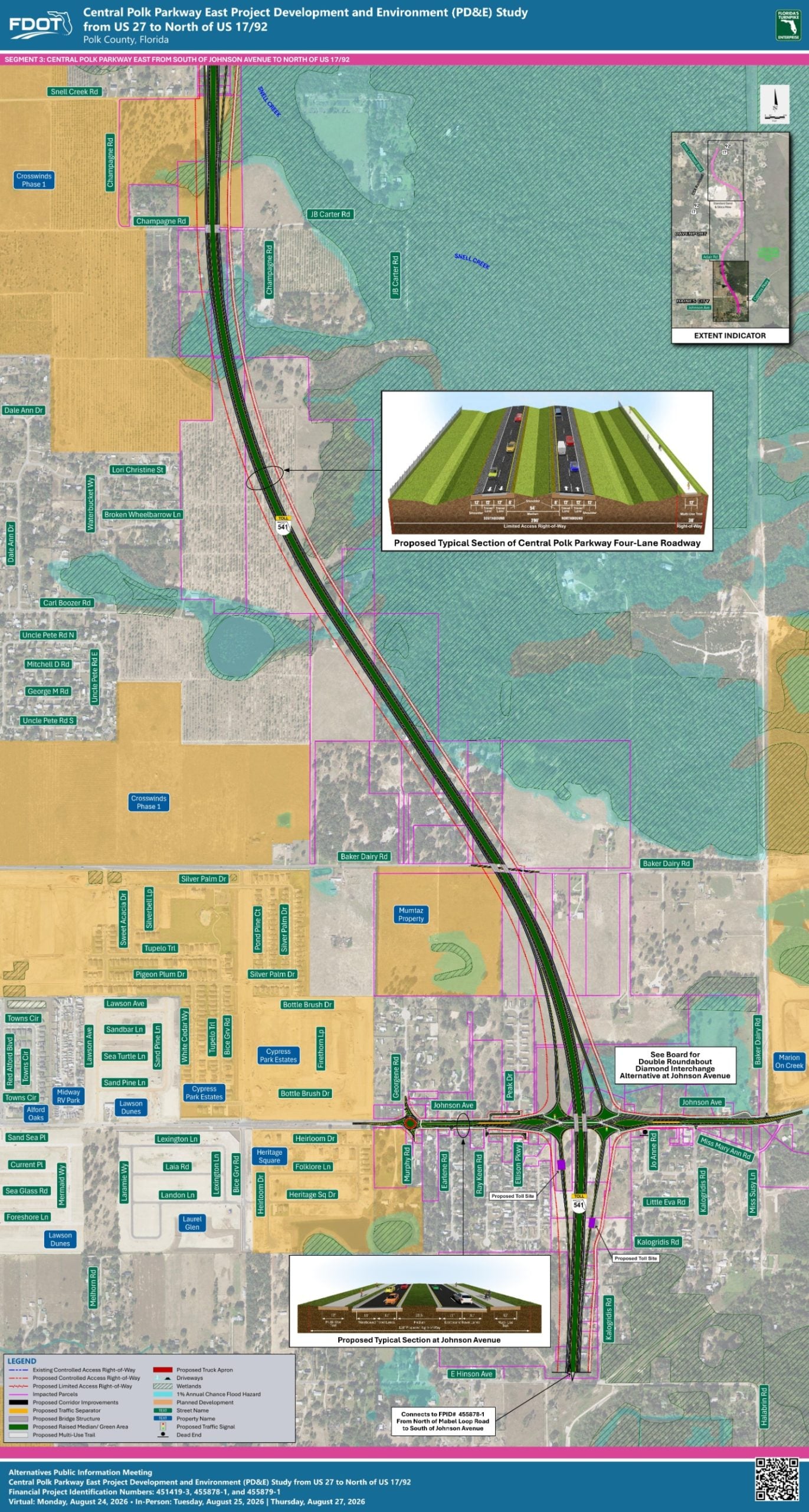
Mainline S of Johnson Ave to N of Snell Creek Rd
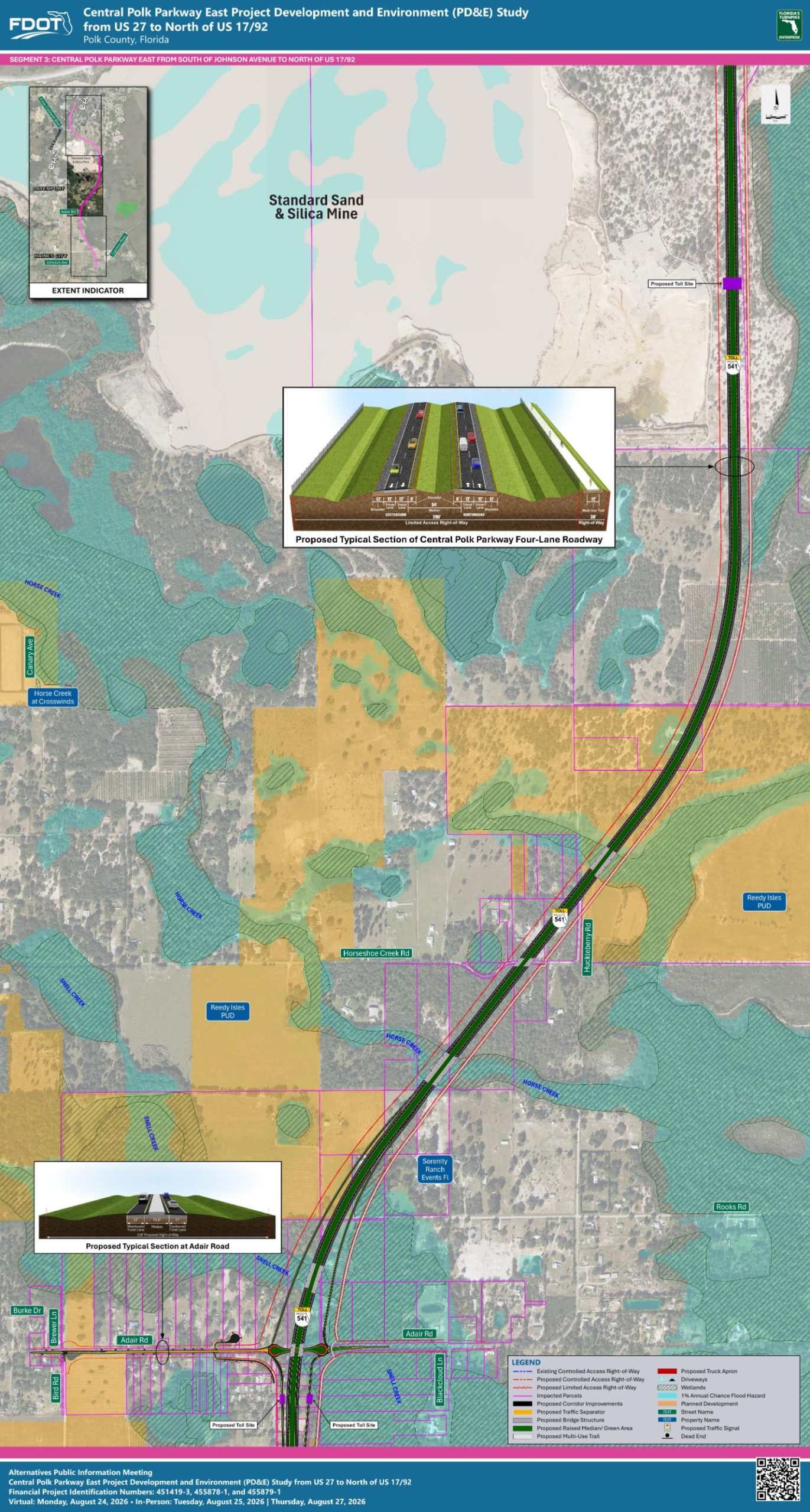
Mainline N of Snell Creek Rd to Sand Mine
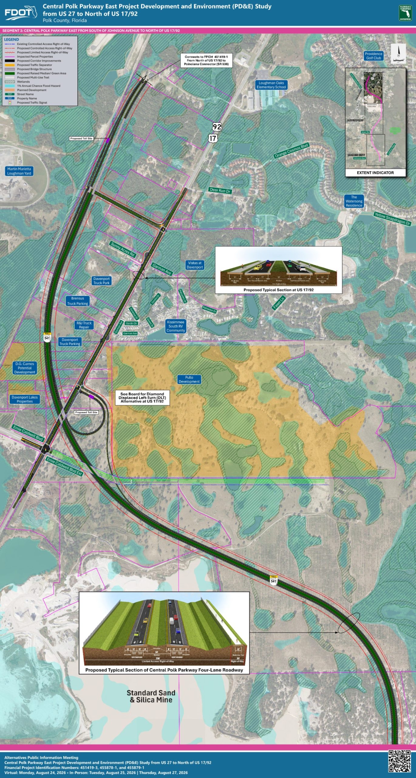
Mainline Sand Mine to N of US 1792
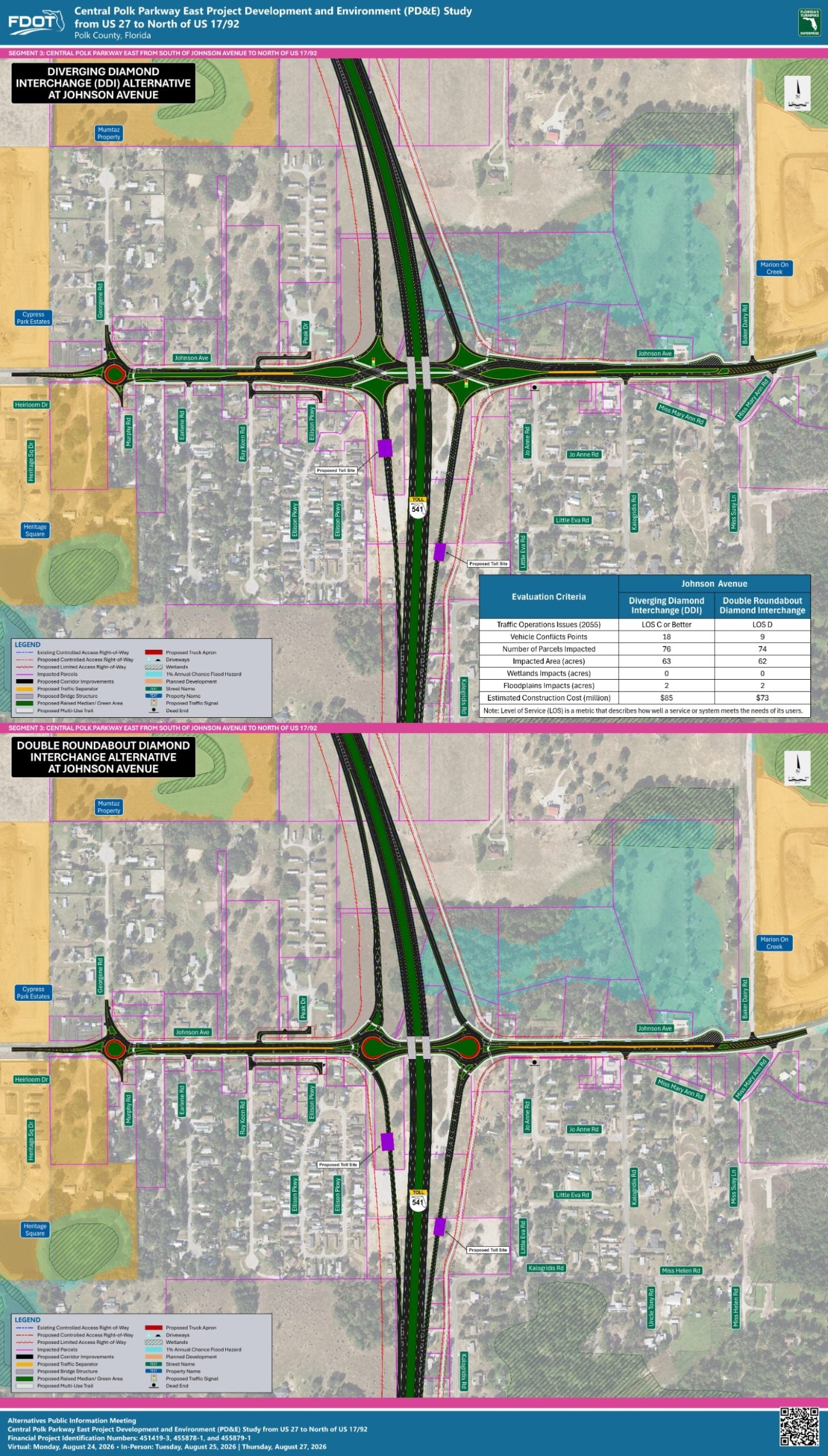
Johnson Ave Interchange
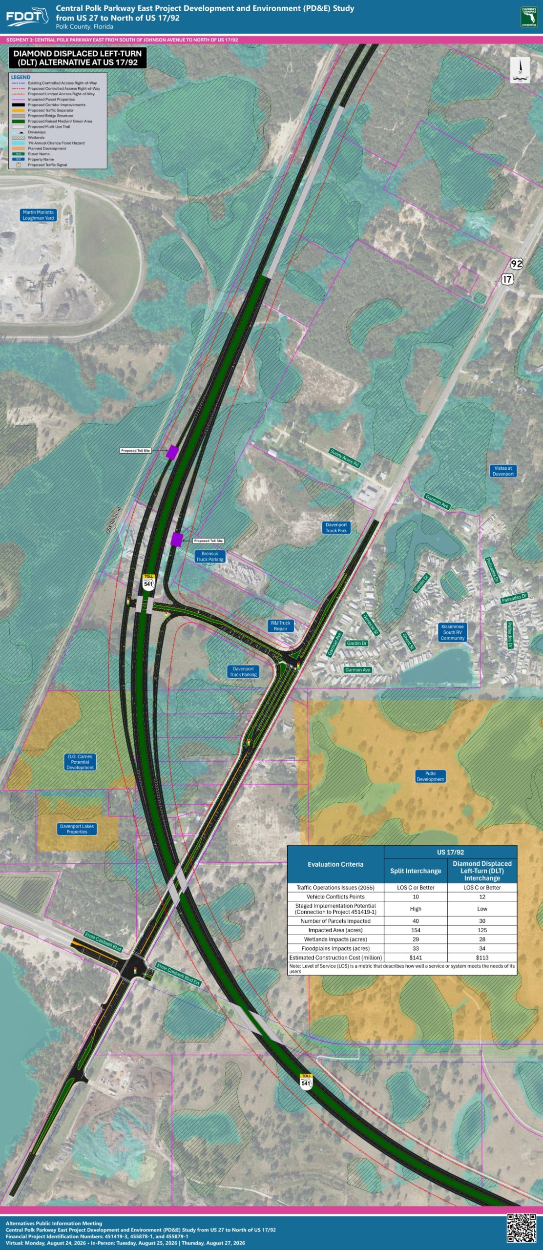
US 1792 Interchange – DLT
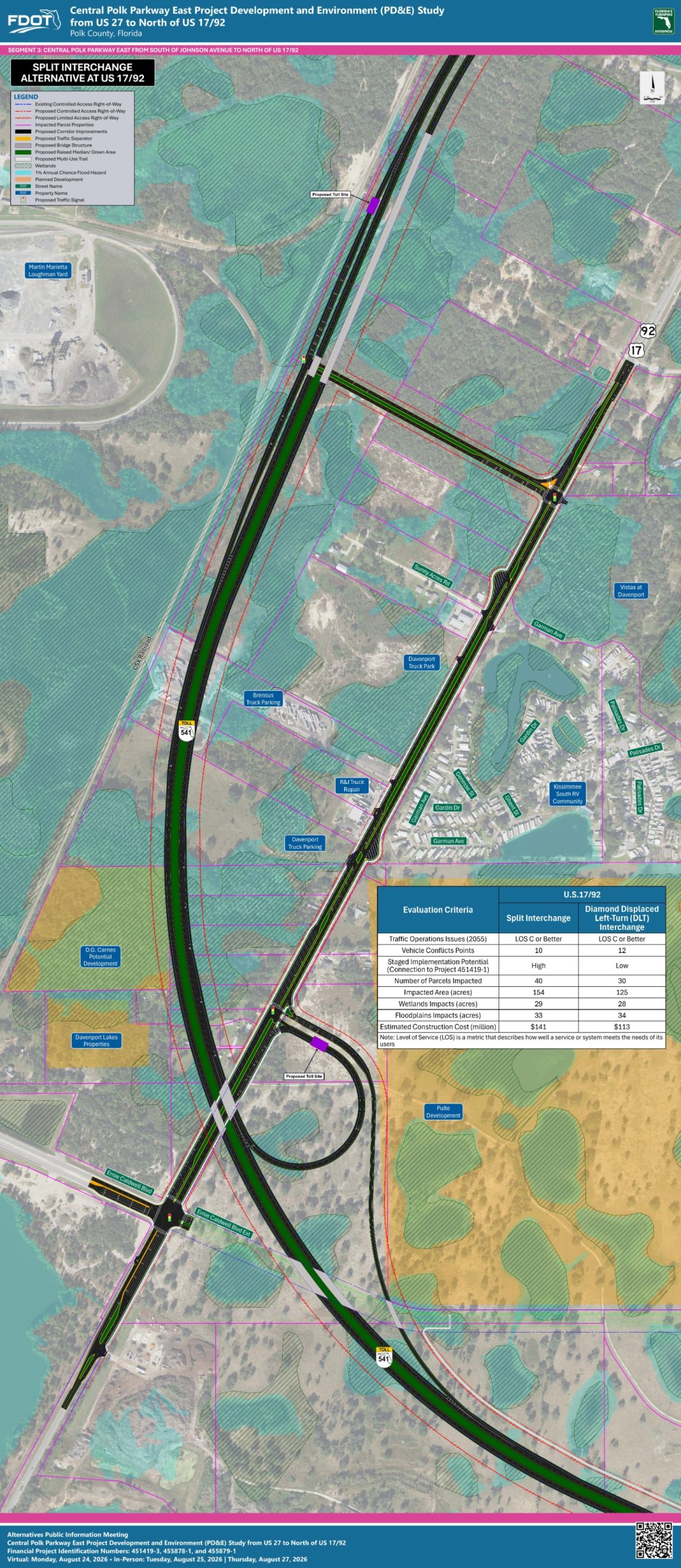
US1792 Interchange – Split
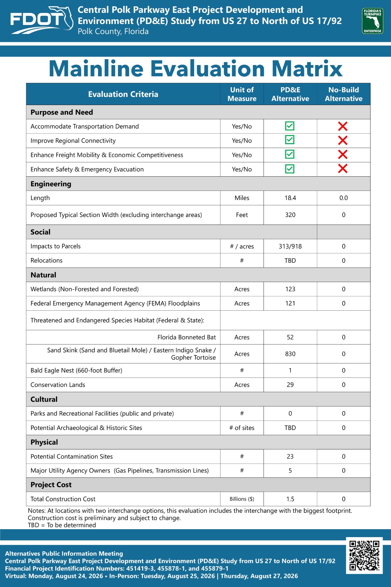
Mainline Evaluation Matrix
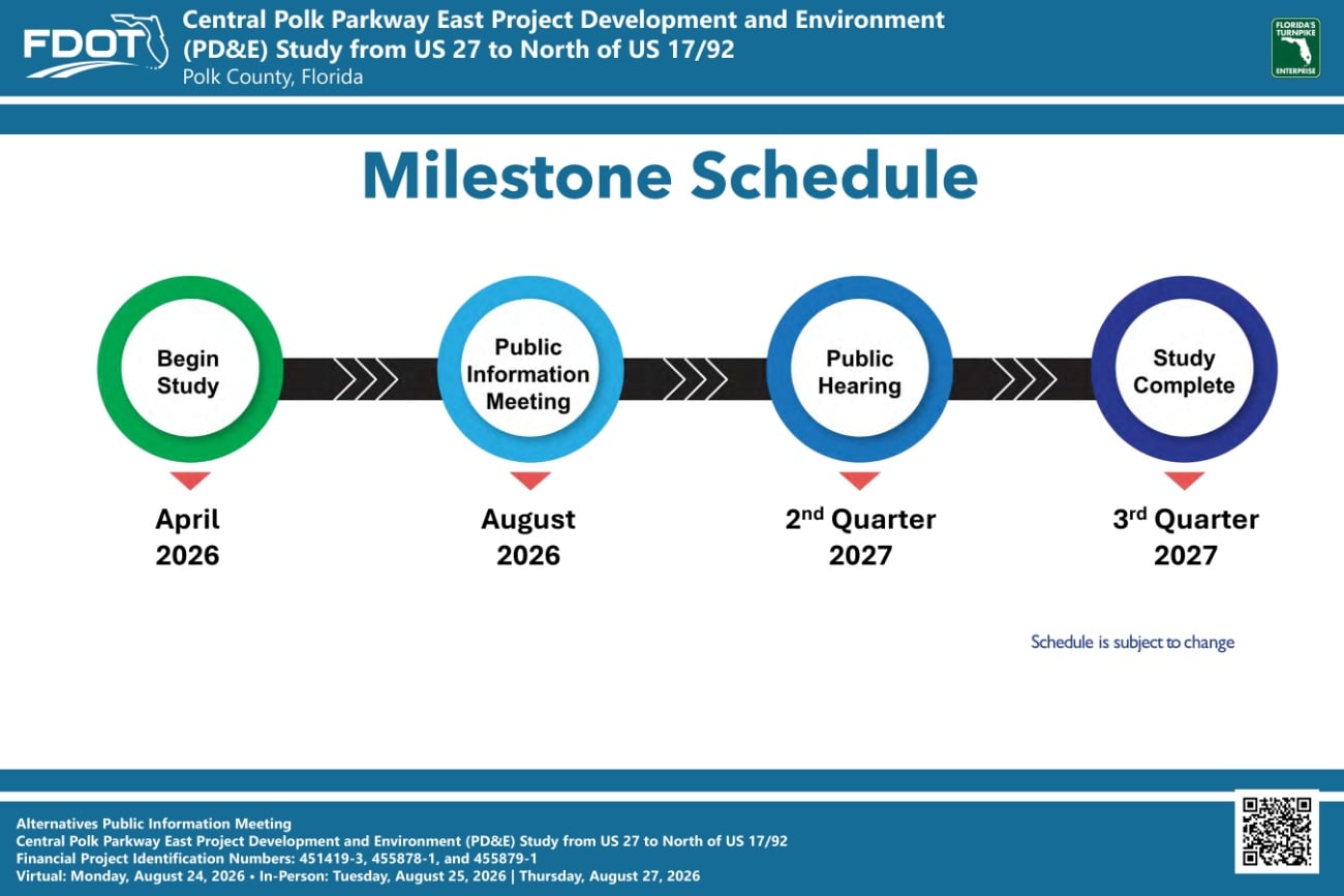
Study Schedule
Title VI Compliance
Contact Information
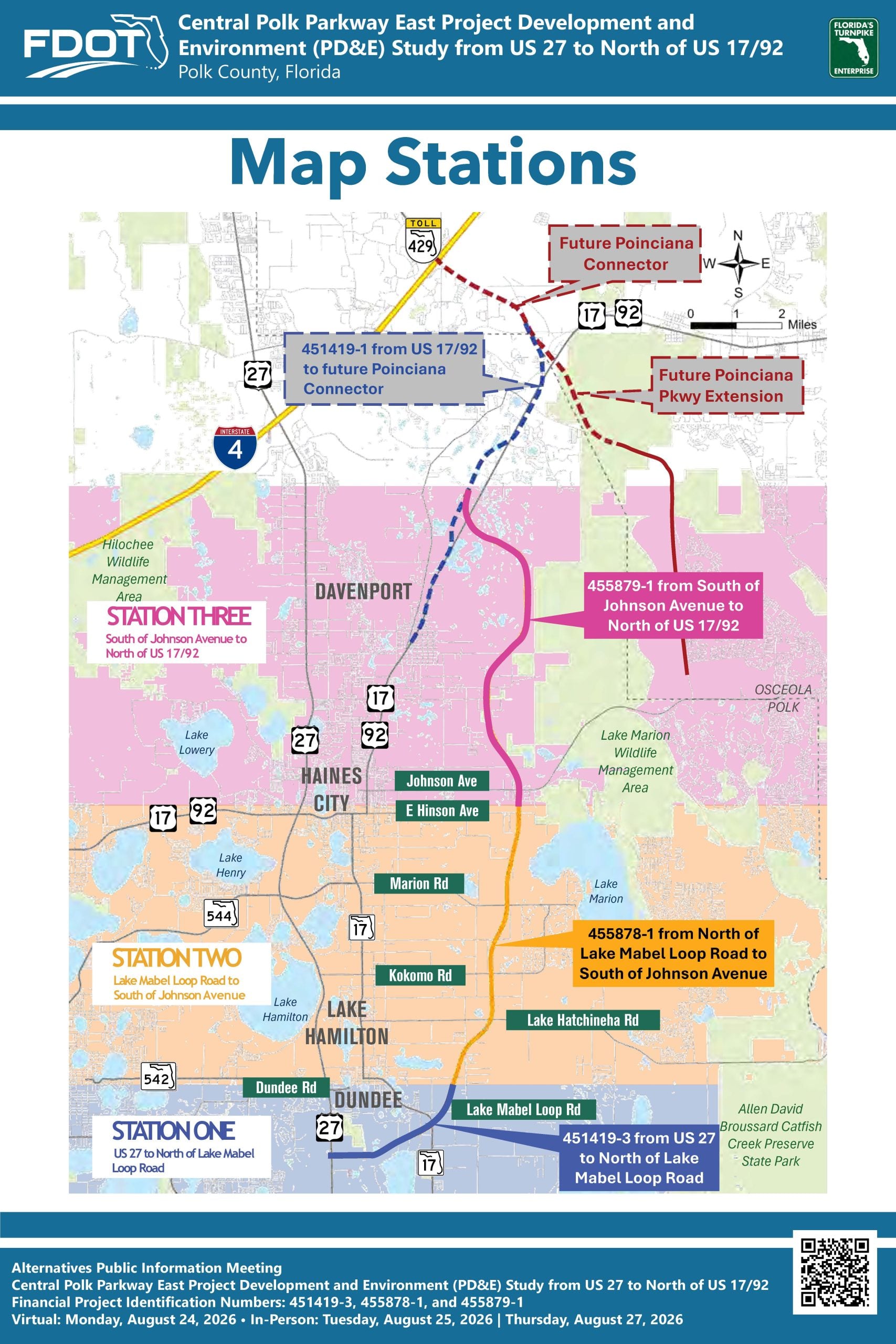
The study area is in northeast Polk County. The study limits begin from US 27, north of Cypress Gardens Blvd/Waverly Road in unincorporated Polk County, and extend to north of US 17/92 in the City of Davenport. The project has been broken into three Project Development and Environment (PD&E) studies – Projects 451419-3, 455878-1 and 455879-1.
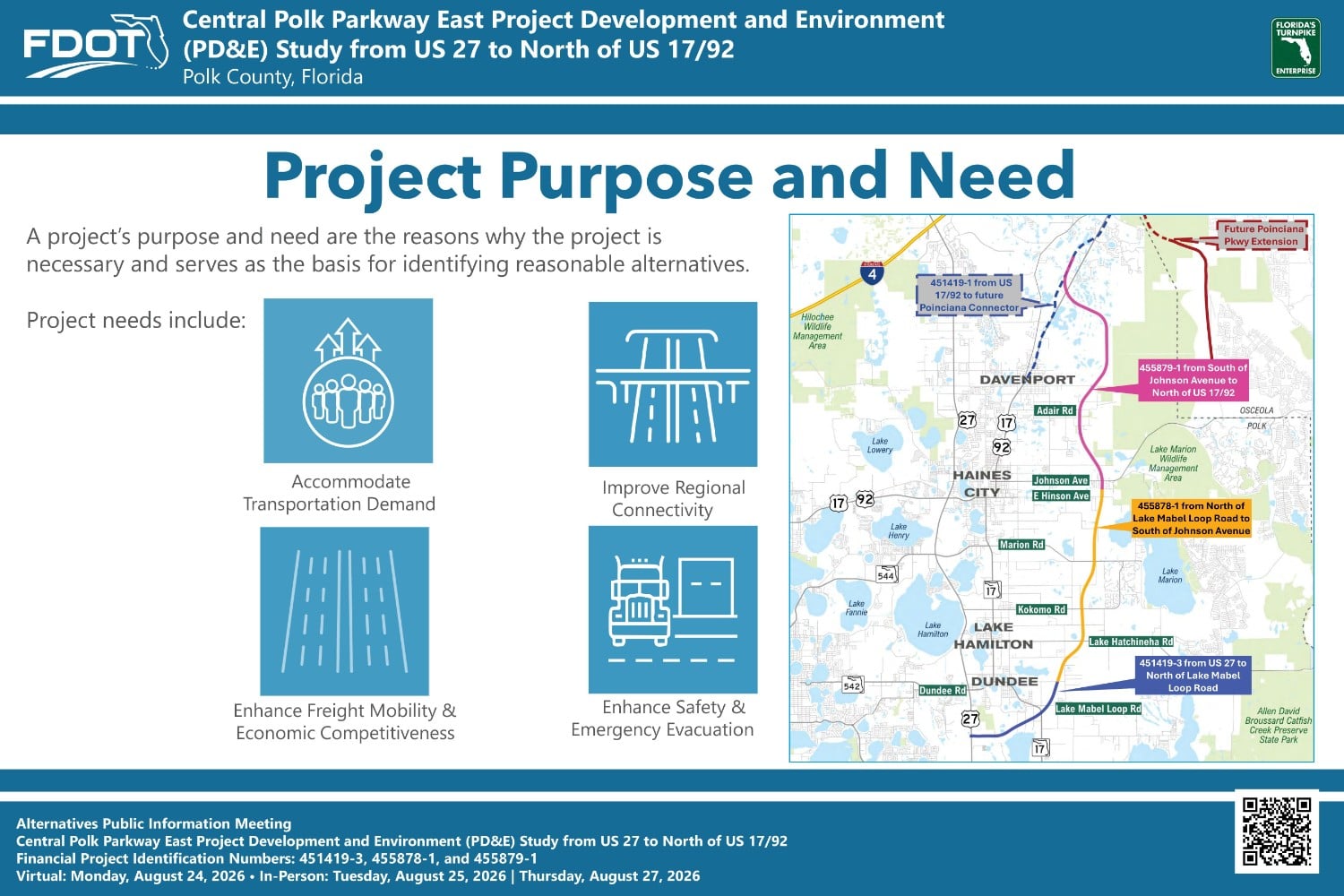
The purpose and need for a project provide the basis for developing, considering, evaluating, and eliminating project alternatives. The need for the Central Polk Parkway East includes accommodating year 2055 population growth and travel demand, improving regional connectivity and system linkage, enhancing freight mobility and economic competitiveness, and enhancing safety, emergency evacuation, and response times.
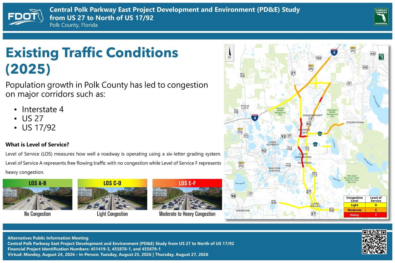
This exhibit shows existing (2025) traffic conditions in the region using a measure of congestion called Level of Service, or LOS. LOS uses a six-letter grading system where A is best, and F is worst. The map illustrates where population growth in Polk County has led to congestion on the region’s major corridors, including I-4, US 27, and US 17/92.
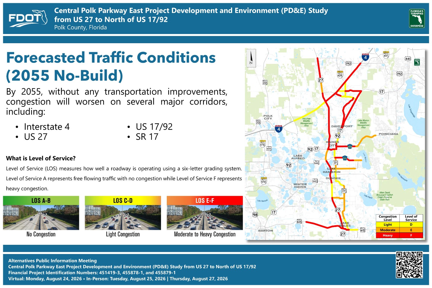
This exhibit shows forecasted (2055) traffic conditions in the region using a measure of congestion called Level of Service, or LOS. LOS uses a six-letter grading system in which A is the best, and F is the worst. The map illustrates where continued population growth in Polk County is expected to increase congestion on the region’s major corridors, including I-4, US 27, US 17/92, and SR 17.
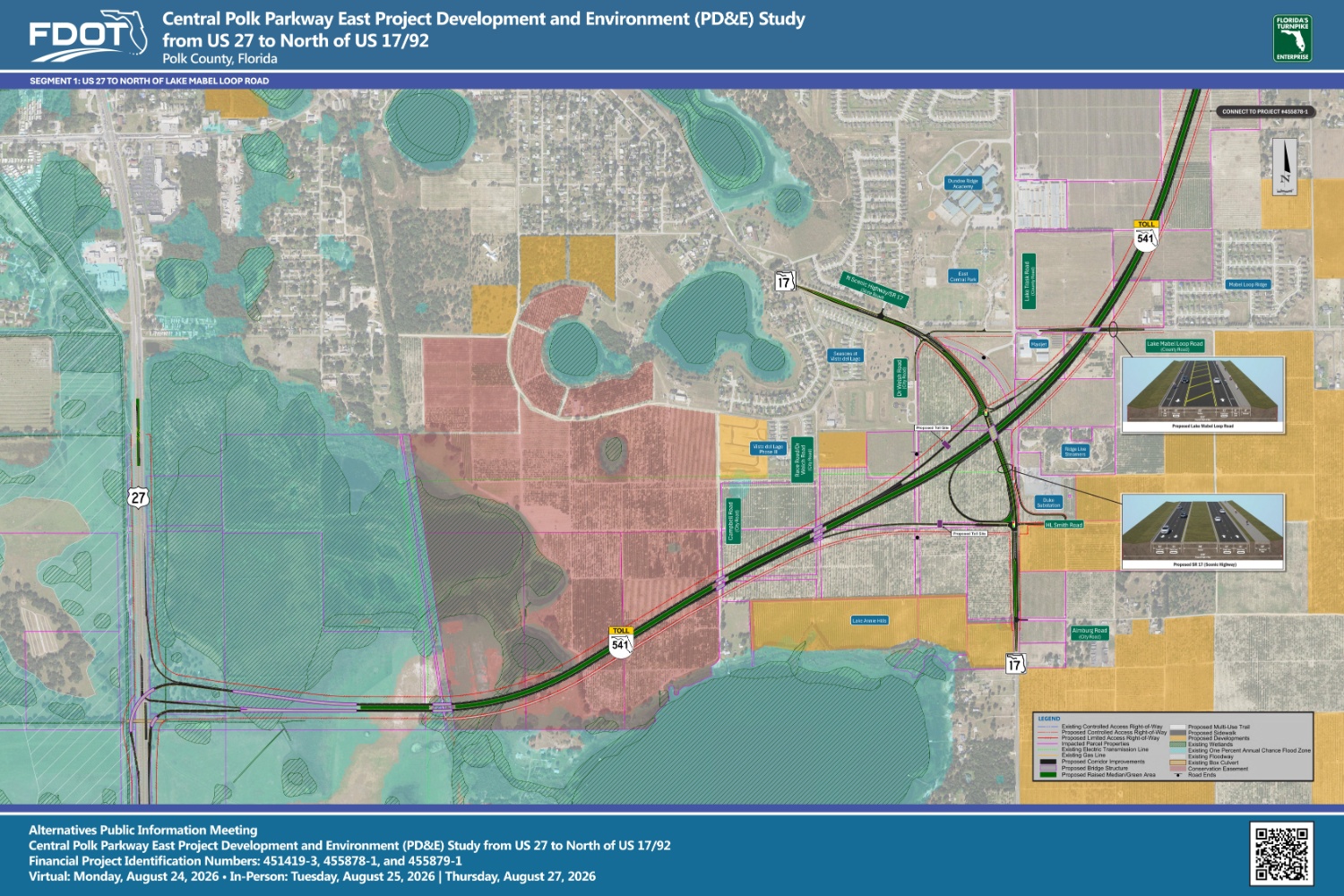
There are 12 boards that make up the entire study limits. Each mainline board shows the Turnpike mainline alternative and one interchange alternative. The other boards show the interchange alternative(s) being considered at each interchange location and a comparison matrix.
All boards are also available for download on the main project website under the ‘Documents – Alternatives Public Information Meeting’ section.